528km – Part 2 More Fells

While the second day in the Lake District was spent wandering around Maryport on the Cumbrian coast I did learn a reasonable amount about the Romans in Britain. The weather while there was pretty poor with low visibility and often rain.

Maryport Harbour Wall

I visited the Roman museum there and I was going to visit the town’s museum about the sea and fishing but it’s one of those museums that only opens on even numbered days or something like that. There is, nearby, the only discovered remains of a Roman Milefortlet which was a fort placed every Roman mile along the coast to protect the country.

Roman Milefortlet 21

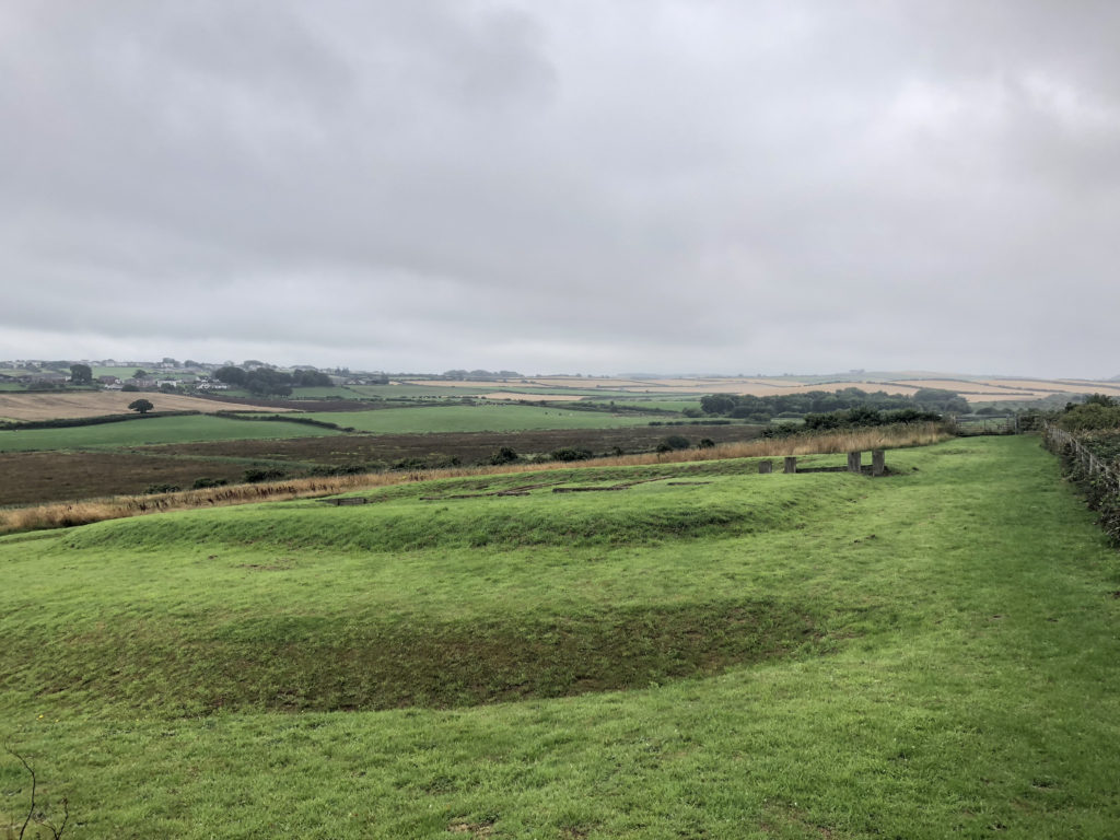
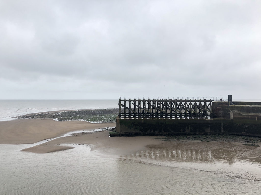
There was also the remains of a salt pan from medieval times.

Salt Pan
Salt Pan

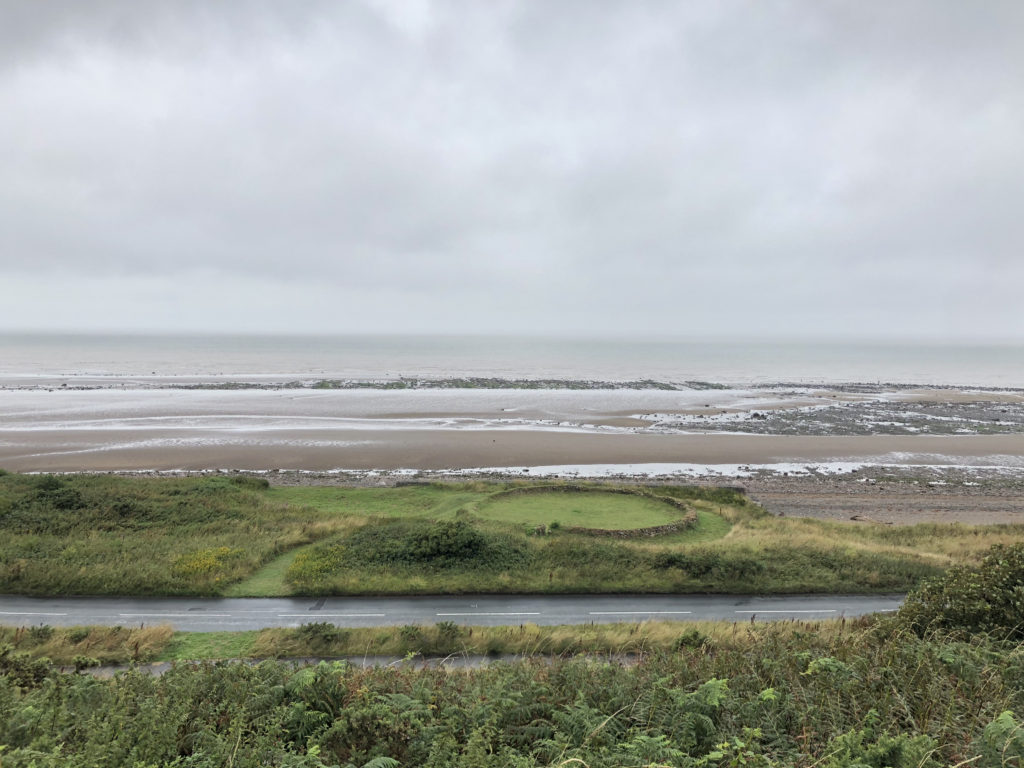
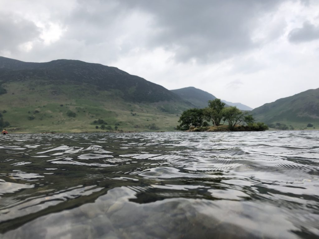
All fish and meat was preserved using salt and much of that salt came from pans like this where the water evaporated leaving the sea salt. This is much like the process used in Maldon. Later that day I drove back to the campsite via Buttermere and the wonderful cake and ice creams that are served there.

Maryport Boat
Maryport Boat

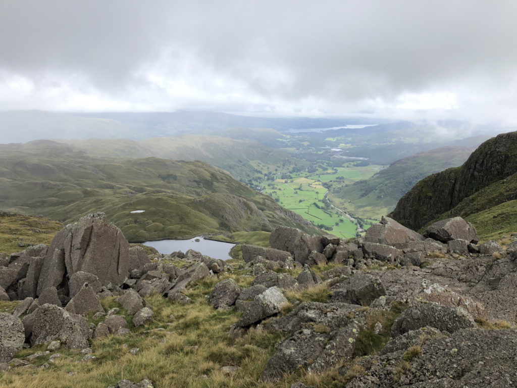
So, my last full day in the Lake District was going to be walking more fells. I decided to try and complete the Langdale Pikes. These are quite close together so once up at height it should be easy to get around. That is if the weather was clear. I started my walk later than normal because the weather was due to clear after midday [it was more like 15:00 but you know, they can’t get it correct all the time]. It’s also worth noting that the temperature at altitude is lower than that in the valleys. So, around 600m up the temp was around 12C rather than the 20C in the valley, along with wind this means clothing must be carried.

I took a route up from the New Dungeon Ghyll hotel up along Mark Gate towards Loft Crag. My first stop was at Thorn Crag, which is written on the map a little way off from where it is and I used a second app on my iPhone for working out where I was with more accuracy. Pretty much all the while I was at the top I was in cloud. This only abated after I had spent a little time at High Raise.

So, here’s the list of fells and pikes reached and where they figure in the Wainwright list:

  • Thorn Cragg  [not on the list]
  • Loft Cragg [number 93 by height – 2270 ft]
  • Pike Of Stickle [number 83 by height – 2323 ft]
  • Harrison Stickle [number 71 by height – 2403 ft]
  • Pavey Ark [number 88 by height – 2288 ft]
  • Thunacar Knott [number 77 by height – 2351 ft]
  • High Raise [number 57 by height – 2500 ft]
  • Sergeant Man [number 69 by height – 2414 ft]

A couple of things stick in my mind; rock climbing up to the top of Pike Of Stickle which was fun but only because I missed the footpath by about three metres. The footpaths were not clear to me at the top an I did a lot of dead reckoning about taking bearings etc. The cloud didn’t help much either. Whenever there was a break in the weather I tried to look for footpaths and remember where they were going.

View From Pavey Ark
View From Pavey Ark

Eventually when I got back down the mountains it was much later than normal for me. I try to walk early in the day to give myself time in case things start going wrong but the weather forced me to walk at a particular time.

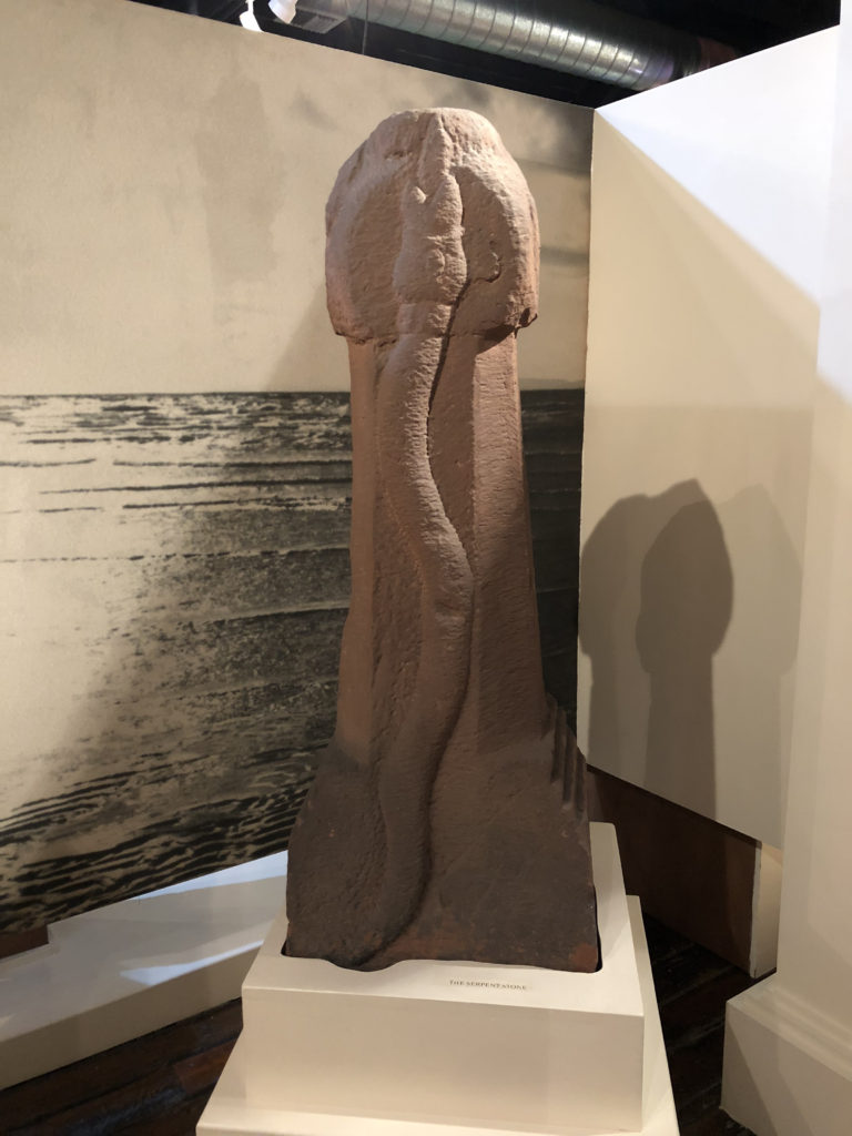
Finally I leave you with a picture of a Roman article. I mean, it’s a penis isn’t it?

Snake Temple
Snake Temple

Bagging A Few More

Over half term I made the journey to the other end of this country to spend some time in the Lake District. While it is quite a drive the views and atmosphere are so worth it.

While in the district of Allerdale I decided to complete a few more of the Wainwrights. There are 214 fells mentioned by Alfred Wainwright in his books and I’ve got a taste for bagging some each time I go to the Lake District. My personal target is to complete the lot by the time I am 60. I’ve got 14 years to go. I need to up my rate a little but the next time I go I am planning some lovely ridge walks that should get quite a few crossed off!

On the first day I went up Walla Crag [number 204 by height].

I parked in Great Wood car park and walked up the Cat Gill route and down again via Castlerigg. It was a lovely little jaunt. Now I had a feel for it I wanted to try and get some of the lower stand-alone fells bagged. I was trying to cross off those that would mean a big detour on future longer routes so this would allow me to make as yet unplanned walks easier.

Next was Binsey [number 192 by height]. A little mound of a fell on its own to the north east of the Skiddaw range.

This was too easy. The car was parked about half way up and was really just a little stroll. The views from the top were amazing. It was a lovely warm and sunny day with visibility running at about 25km. The mist was so fine that I couldn’t see the Scottish peaks but could just see Scotland across the Solway.

Derwentwater Withies Derwentwater Withies

Another day, another walk. This time up Cat Bells [number 189 by height]. I had already completed this particular fell and so wasn’t too fussed about climbing it but I had planned to meet a work friend there.

It was pretty busy at the top and plenty of people were making this their first Wainwright. I t was nice to see so many people enjoying this countryside. The views are just lovely.

Walking down Catbells and I saw this sheep just standing and staring.

The Hills Have Eyes The Hills Have Eyes

The next day was a rest day and I went on a narrow gauge railway and then visited Muncaster Castle. The walk back took in a short distance by the river Esk. The air was so still that the water looked like a mill pond.

River Esk River Esk

I drove back to Keswick through two mountain passes. One was Harknott pass and this is a most ridiculous road. There are hairpin bends with a gradient of 1:3. There were times I couldn’t see where the road went out the windscreen while turning because the road dropped away so fast. It was a very satisfying drive. Then, there was the Wrynose pass which wasn’t as spectacular but was still very pretty.

Another rest day followed with a lovely time doing various things together with going to watch Solo. The final walk day was spent hanging around Crummock Water after getting to the top of Rannerdale Knotts [number 210 by height] adjacent to the lake.

I’m annoyed that I forgot my hat. I don’t do well in direct sunlight, I have a lack of natural head covering, not that I’m too fussed about that, and I burn easily, even with sun lotion on [SPF 50].

Crummock Water Crummock Water

That was it for the week. A journey back to the South East and good broadband bandwidths beckoned the next day. It was good to get back to upload speeds in excess of 0.4Mb/s, it was needed to chuck photos into the cloud.

Derwent Water Derwent Water