Here’s a map of what has become my standard 5 mile (8 km) run. At the time of writing I am running this in the dark with my trusty head torch. It is about 3.5 miles of cross country running and 1.5 of road or pavement running. I really enjoy it.

"Nothing but the rain"
Here’s a map of what has become my standard 5 mile (8 km) run. At the time of writing I am running this in the dark with my trusty head torch. It is about 3.5 miles of cross country running and 1.5 of road or pavement running. I really enjoy it.
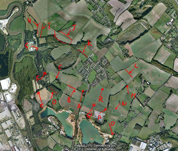
When ww and I talk about routes for walking the dog we give names to parts of local footpaths so we can say the name rather than give a six figure grid reference. Here’s a snip of Google Earth with some arrows pointing at vague features.

A – Sports Field
B – Across middle field
C – George Corner (it’s where our dog did his first “on walk” poo)
D – Bushy Bushey Wood
E – Solar Farm Path
F – Rotary Hill
G – Cock Corner (there’s a graffiti picture of a penis)
H – Burham Route Road Return
I – Burham Route Field Return
J – Burham Route Path
K – School Path
L – Middle Vineyard
M – Vineyard Hill
N – Sheep Path
O – Aylesford Corner
P – George Gate (The dog once ran so fast he couldn’t stop at the gate and hit it hard)
Q – Pylon
R – Stake Corner
I’ve missed an arrow by I and J and this is called Burham Route Near Stream.
So there you have it. A list of terms used in a single household about the local area that is of no use to anyone!