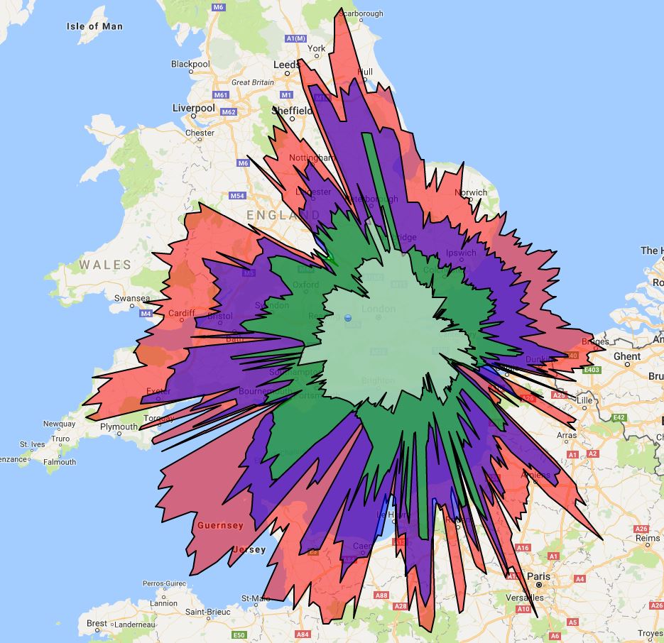
Here’s another view of my VRS Splat:

"Nothing but the rain"
Here’s another view of my VRS Splat:
This is the output from my radar server. If you want a better view then you can ask me for the details.
Hmm, there are page formatting issues. Not sure I care enough to fix them.
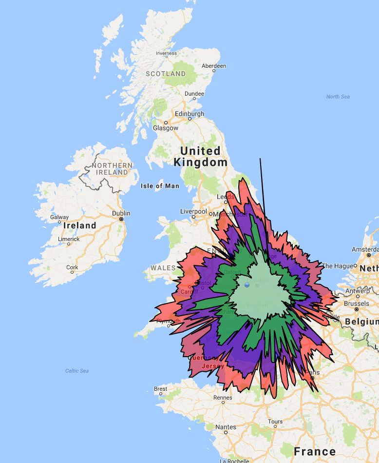
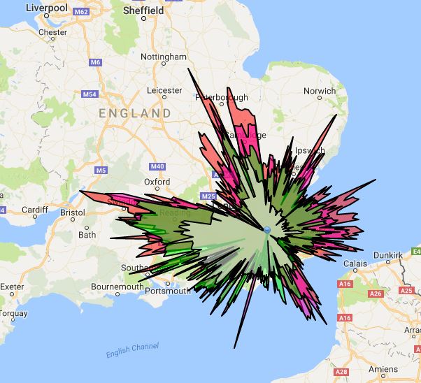
With reference to the previous communication I can update the main blockages on the ADS-B splat. I wrote about this before here.
The blocked area labelled 1 covers the North Downs. This natural boundary lurks to the NE of me and I can’t do a great deal about it.
The blockage labelled 2 is, I believe, down to the aerial being inside my loft and the terrace houses of my block extending in that direction. I wrote about that here. The only way to improve this range would be to get the aerial placed above the roof of my house, which is not a job I am going to undertake. I may, however, consider getting someone else to do it.
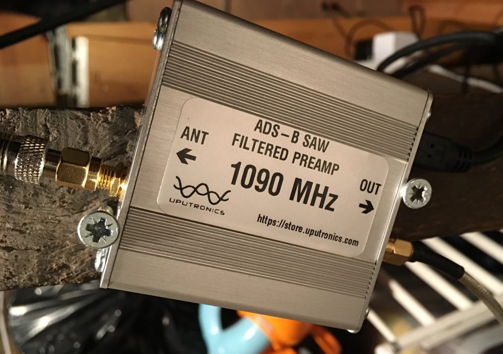
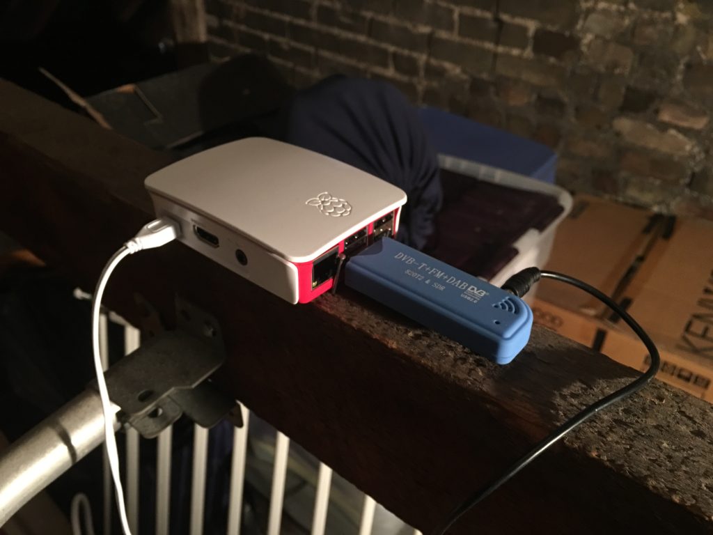
These communications contain many items concerning the virtual radar system that lives in my loft and you can see a selection here. A short while ago I decided to buy an pre-amp and filter for my system to improve the range and number of aircraft being received. So, this communication now requires a large number of pictures to give you an idea of what this means.
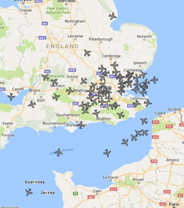
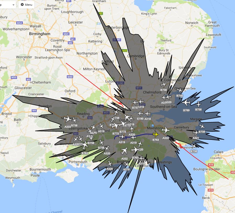
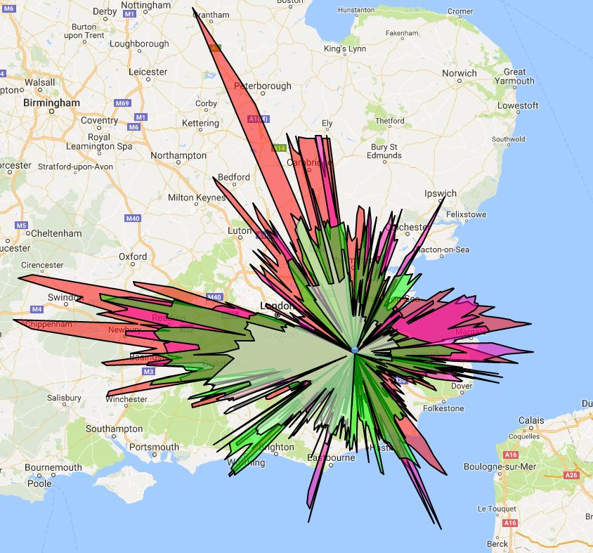
In the above picture you can see that there are around 20 aircraft and the black area [the range of the receiver] doesn’t quite reach Norwich, Portsmouth, Bristol or Calais. There is the NW-SE block as described before.
This coloured splat gives pretty much the same information but uses colours for the ranges of aircraft at different altitudes.
I bought a filter which only allows signals close to the 1090MHz requirement through to the USB stick I bought. It also acts as a pre-amp so there is an overall 14 dB gain.
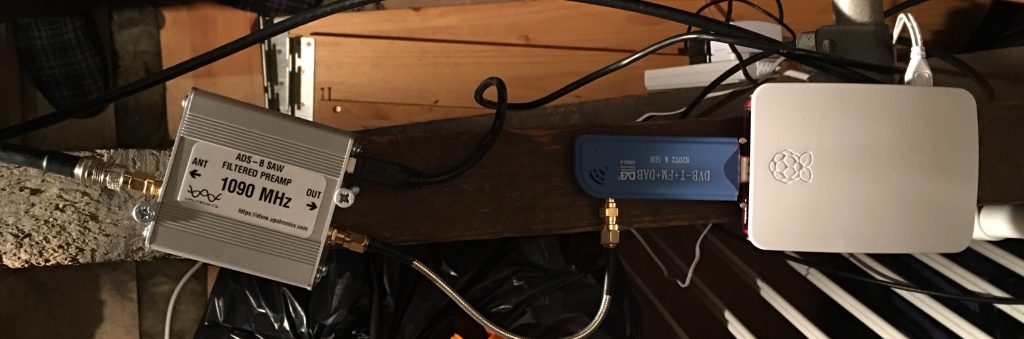
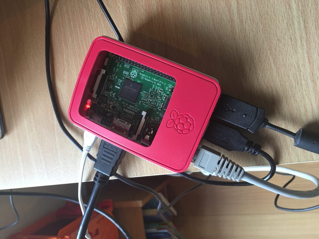
Here is the whole Virtual Radar system living in the loft:
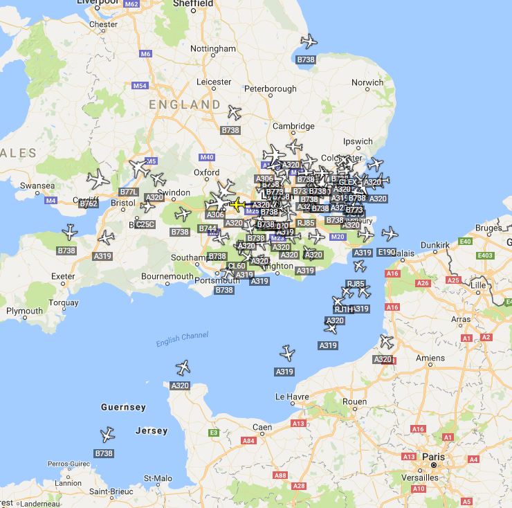
Once this kit was turned on I looked at the DUMP1090 output from the Raspberry Pi and pretty much shat myself at the number of aricraft shown:
When this view is compared to the twenty or so aircraft that I had before you can see an immense improvement in the receivers ability.
Virtual Radar Server is a program I use on the RPi for a more detailed view, there are quite a few customisations you can create also. It is the software that will create the splat over time, keeping track of the aircraft and their position.
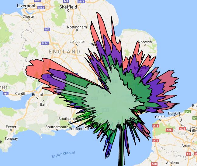
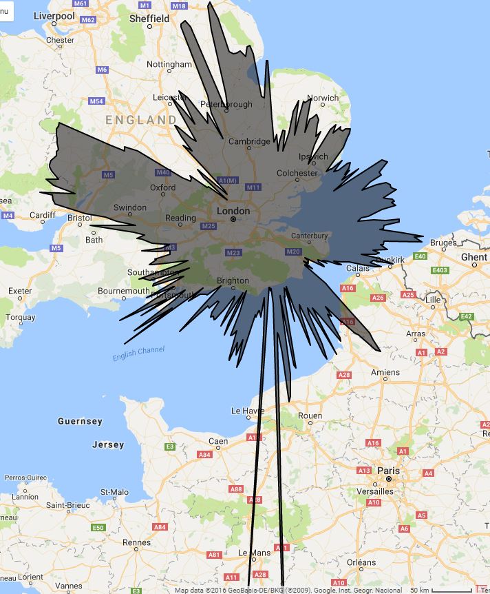
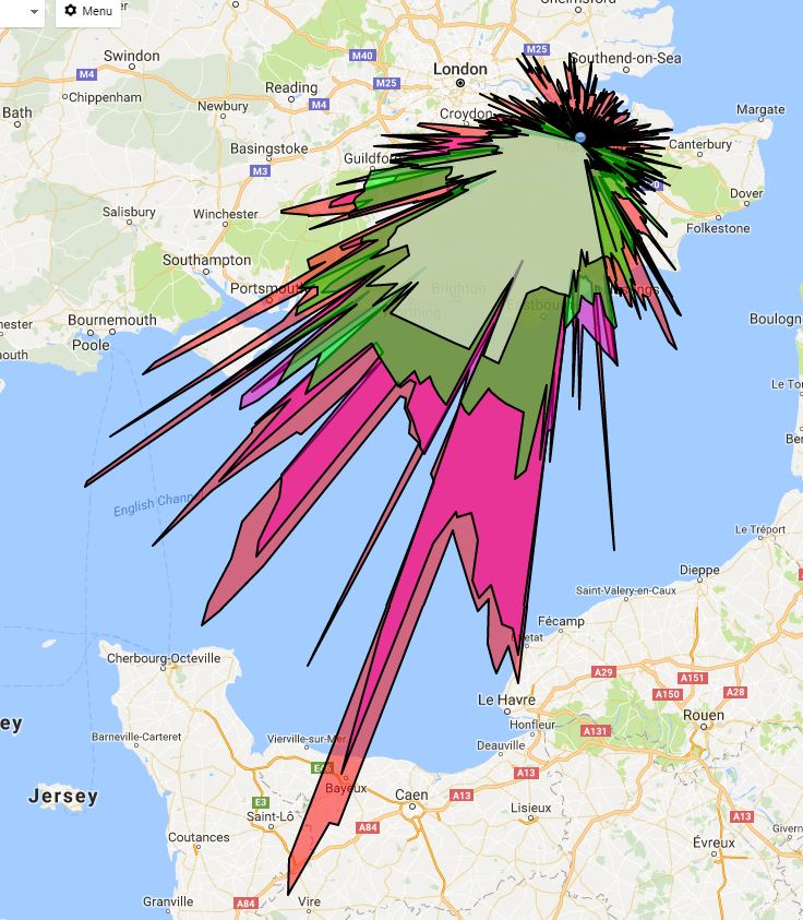
The distances have increased as has the overall coverage. I now track around 100 aircraft at a time. For a small sum of money the overall increase in detail has been terrific. I can now reach over northern France, over Wales and a lot of the channel to the SW.
A side by side comparison.
I am aware that in some places on the internet caturday is a thing. I do not care for this. Nor do I care for cute dog picture stuff. It’s quite boring, especially when associated with a meme [a word now misused]. There is a smaller, some might say darker, part of the internet where comparing the range of an ADS-B receiver is a thing. These are called “splats” and so here is my Splaturday picture.
There are other communications cover this sort of thing here and here.
A while back I wrote about setting up an ADS-B detector in the loft. There are six communications I think.
And this one makes seven.
What’s the point in having an ADS-B receiver if you aren’t going to use it when you are out of your house? So, I managed to set up some wizardry on parts of my home network and now I can see the display from outside the confines of my wireless network. I’ve done some port forwarding and other lovely stuff which is easy enough if you are adept at googling, which I am.
Family thinks I’m a god because I can use regedit to fix a computer. But I’m really quite good at JFGI.
— Ian Parish (@iparish) November 20, 2016
So, I now have a Virtual Radar Service for the area around my house that I can log in to from anywhere in the world. I did have to set up a Dynamic Domain Name Service for my modem as I am not lucky enough to have a fixed IP from my broadband supplier. My router even informs the DDNS service what its new IP is whenever it restarts and because this just seems to work it makes me happy.
I did have some minor issues with the radar service as it uses Google Maps to provide a nice background and because I was using this outside of my home network I needed an API key to make this work. That was reasonably easy to set up but then it turns out that Google recommend you secure the key to a particular site so that other people can’t use your key and steal your Maps data, which would then mean Google would charge me.
It took a little while to get the formatting of this securing correct but I think I finally managed it. I guess I’ll soon find out if Google send me a massive Google Maps API bill soon!
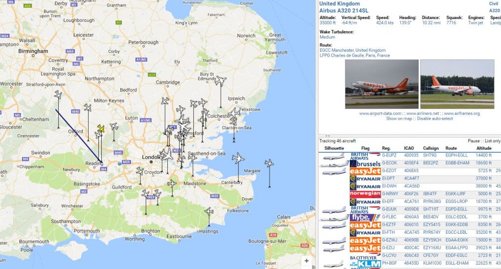
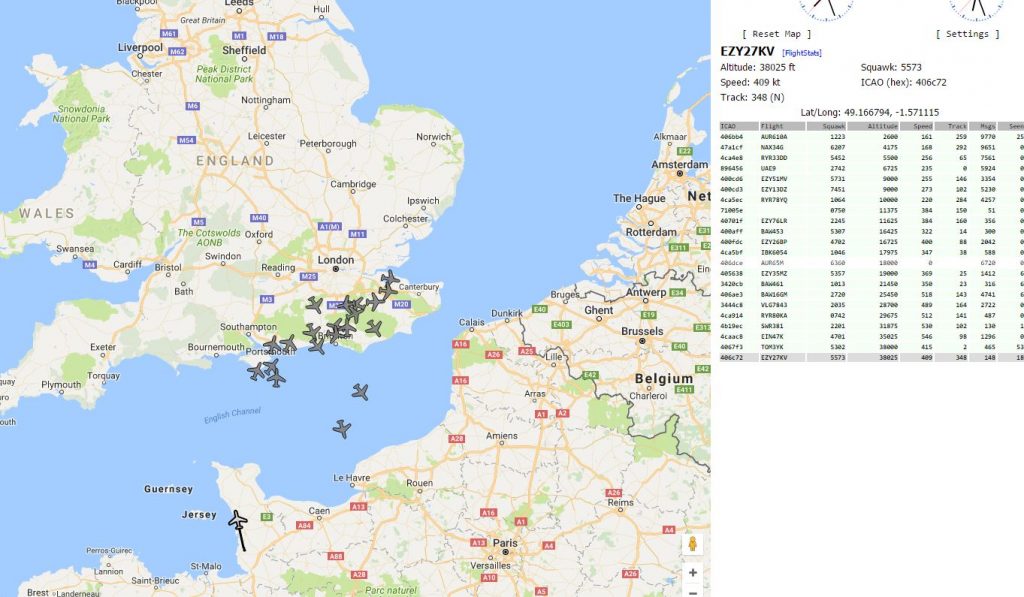
So, I can log in to my radar server from anywhere and view it on a desktop or mobile device. That way I can see what my home system sees. It doesn’t catch all planes because some won’t be broadcasting position, see the MLAT communication. Below is a picture of a browser with my radar server running.
If you want access I can allow it to you. Just let me know and I’ll arrange a login and password and also give you the URL.
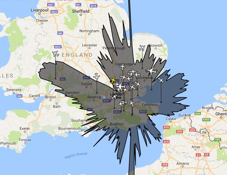
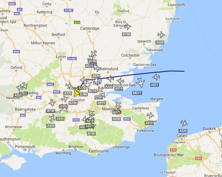
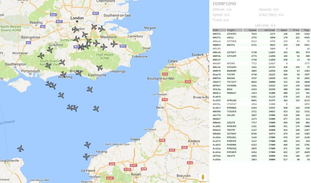
There’s nothing on at the cinema I want to see tonight so how about a picture of the aircraft I am currently tracking?
![]()
I don’t think it’s too bad. I’ve been working on port forwarding and things to try and see stuff outside my home network and it’s getting there.
This isn’t all the aircraft my receiver is getting signals from but it shows the aircraft with known positions, the ones that broadcast their GPS location.
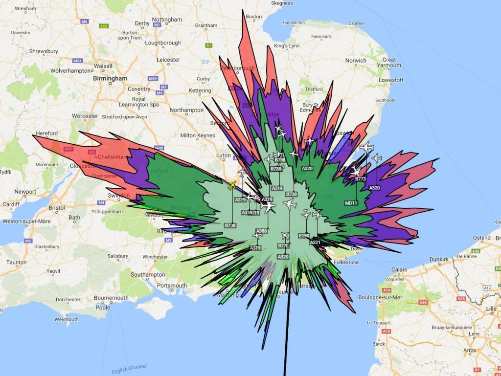
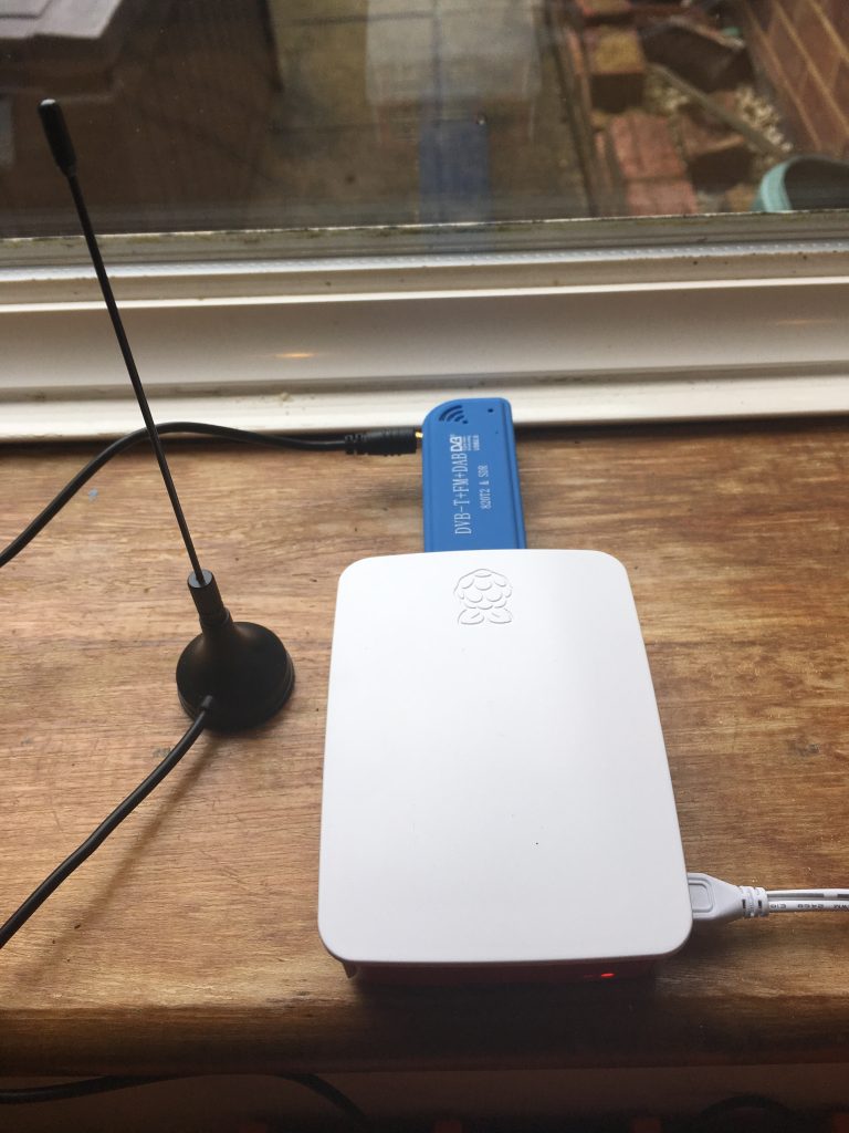
A short while ago my proper aerial turned up for the ADS-B system I have running in the loft. See this communication and this one also. This new aerial means I should have a better receiver based in the loft. It is currently picking up 47 aircraft flying within range and the Virtual Radar Server gives the following as a webpage output:
There is a sidebar which connects to the web and gives me information about the selected aircraft and the others flying within range. This does not show all aircraft, only those with an ADS-B transponder. I also supply my data to a MLAT service for 360Radar.
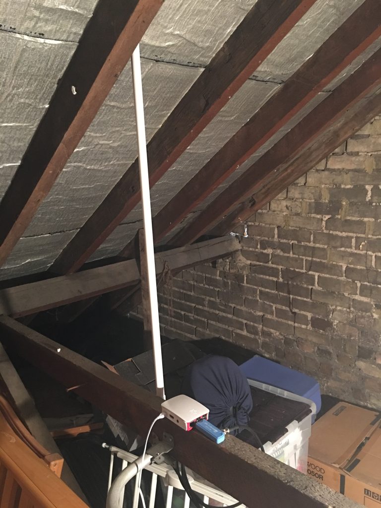
The above photo shows the system in the loft. The white stick is a surround for the aerial. This connects to a dongle which connects to a Raspberry Pi3 and this, in turn, connects wirelessly to my home network.
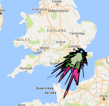
I know you really want to know about the splat so here they are. Firstly one from before the new aerial.
Here’s the latest, all altitudes are in one colour.
The range is a bit better with two very odd pips into central France. The following is a colour one for you mammals out there.
The next thing is to try installing a purpose made ADS-B USB stick. After that I think I will stop. It appears to be one of those “who can get the best splat” things online and I’m not interested in taking part.
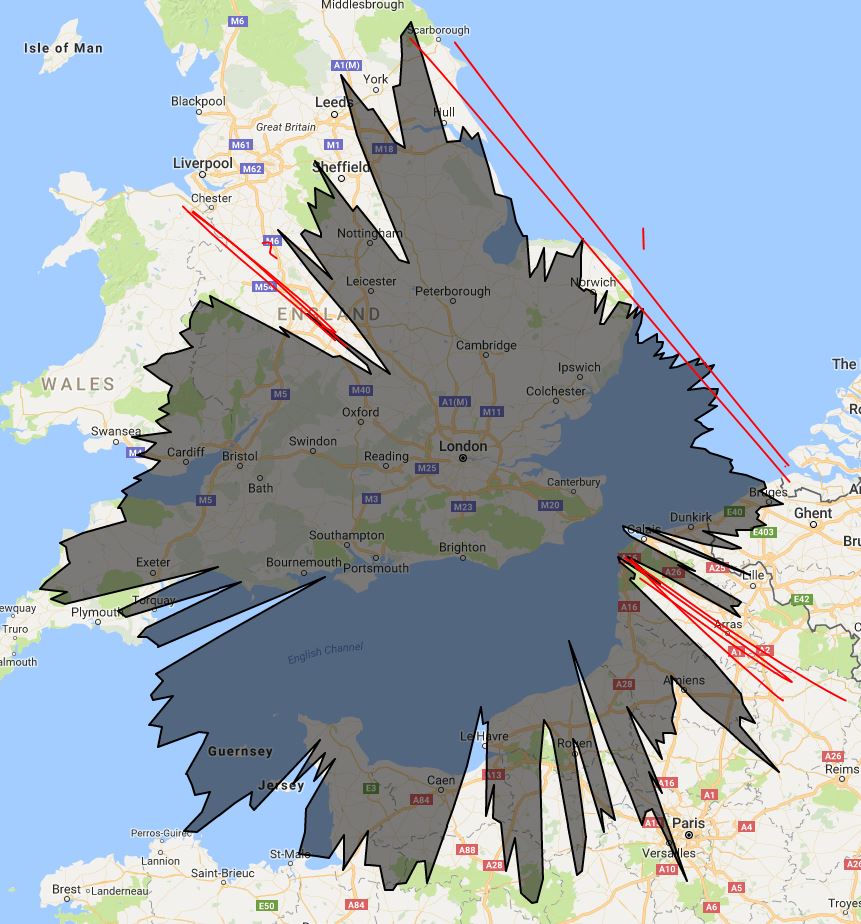
I have noticed that I have decreased range in two directions on the ADS-B receiver.
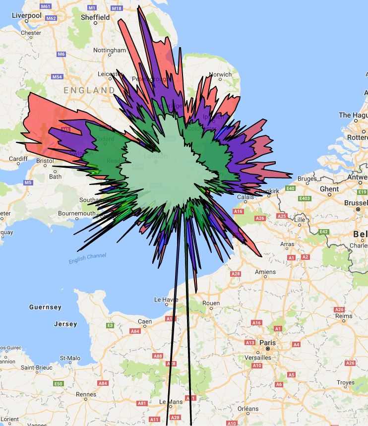
Because the colours represent the ranges at different altitudes I’ve got a version with just one colour.
This one shows a clear restriction in range in the NW and SE direction as marked by the red line. I do not know what is causing this but I have an observation to make. I live in a row of terraced houses and the direction of the road matches the constriction direction. While the aerial is in the loft there is extra “stuff” in the way in these directions because of the houses next to me.
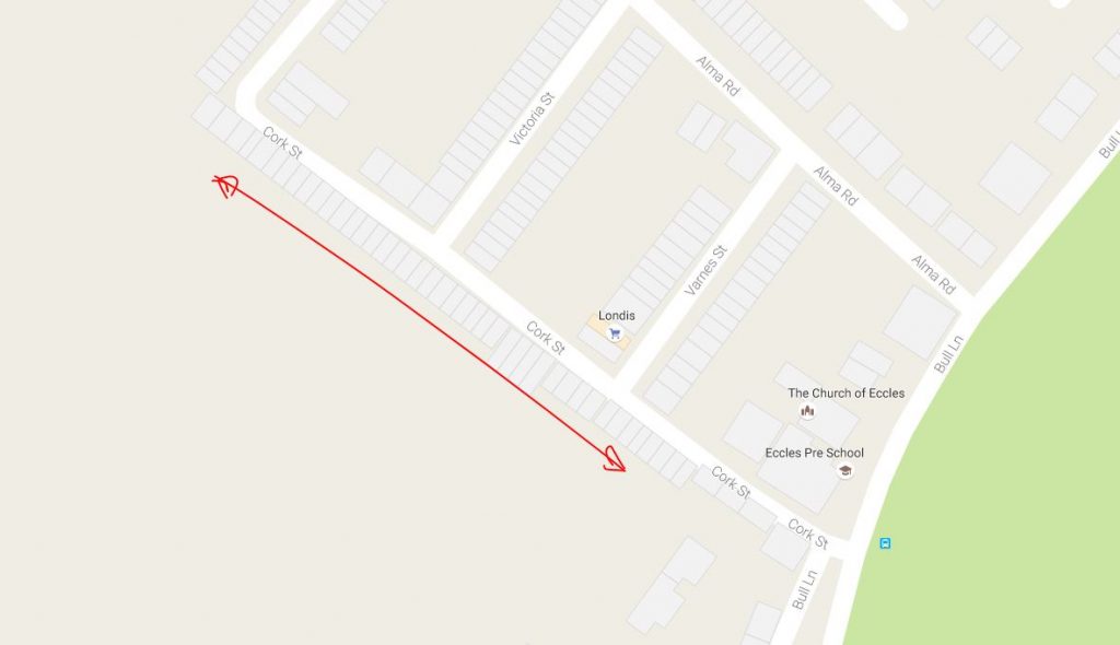
I’m pretty sure this matches up. There is definitely a correlation. Whether that means there’s causation I don’t know but it seems reasonable. I might write a communication about altitudes and the natural obstructions around me [I’m looking forward to the maths involved].
This is an update on the ADS-B device. I have written about this in the previous two communications, here and here. So, on Tuesday 2nd August the Raspberry Pi arrived. Since then I have been setting it all up so the receiver is no longer dependent on the PC being on.
The first thing was to install the correct OS on the Pi. The picture shows it in initial phase with monitor, ethernet, keyboard and mouse all connected. Once the OS was installed I had to tell it to not load the GUI and just run a command line. Then, I got it connected to the network and pretty much removed all the cables apart from power.
I can connect to the Pi using SSH and run script from the command line. Next phase was to load the USB stick drivers and software. This was reasonable. Next up was the ADS-B reading software, installing and getting it running seemed easy enough and then I had to adjust some code to make sure this service starts up from boot. Next software to load was the MLAT server program, this was easy enough although initially I couldn’t quite find the correct code to check it was running.
Then, the whole set up was tested in the dining room window.
Today has been the task of moving the unit to the loft. I didn’t have any power sockets up there so one had to be installed and that took the time! Once that was done the system just needed to be secured onto the main beam in the loft. The important thing is to keep the length of the cable from aerial to dongle as short as possible, this increases the signal going into the Pi. The loft set up has been tested and it is running fine.
I have access to the Pi either via the PC using a program called PuTTY or the iPhone using an SSH connection. I can shut down the Pi remotely and monitor the internal temperature of the device. It is running at a range of 50-60 Celsius. Using a Pi to run this software is a bit like taking a sledgehammer to a walnut. But, it is independent and runs remotely. I am happy this procedure was reasonably straight forward!
The next stage is to get a more specialist aerial and maybe a more specific USB Dongle. However, this is one of those things where the amount of money you spend can be unlimited. You know, I could just install a radar up in the loft. However, here is the current splat for the range of the aircraft from my ADS-B receiver.
Now that I’ve been reading a bit more about this type of thing I can explain a little more. ADS-B is broadcast by many aircraft and they send this on 1090MHz. These are the signals I receive in the loft and can see on my Virtual Radar Server software. I also send these signals over the internet to a new “radar” website. The ADS-B signals contain bits of information about position and heading, these are sent to a server which can determine positions of other aircraft by using time differences between signals arriving, this is called MultiLateration or MLAT. My Pi is part of this network allowing Radar360 to “see” more aircraft than just ADS-B alone.
Further to my previous communication about my virtual radar set I now have been investigating what can be done. I’m waiting for a Raspberry Pi and then I will be able to move the aerial unit higher in the house.
In the mean time, here is a “splat” of what I can “see” using the original aerial and no RPi.
Here’s a version zoomed in a little. I’m thinking of taking the unit to the Lake District soon!
The different colours represent aircraft at different altitudes. The higher the plane the further away it can be seen.
I’m interested in aircraft. I don’t know why it started but it’s pretty much always been there. I grew up near Stansted airport and I can remember seeing the Space Shuttle visit in the early 80s, I saw the 747 and Shuttle circle around from the primary school playing field. When I studied art at secondary school every picture of mine contained an aircraft much to my teacher’s annoyance.
Nowadays it’s easy to see aircraft on the web. I have the planefinder app installed on my phone and often tweet when I spot an A380. I only really tweet the A380 as it’s massive and extremely beautiful.
Spotted! 9M-MNF (MH3) using @planefinder https://t.co/eOkZ5aOMBe pic.twitter.com/3IQx0fcfaE
— Ian Parish (@iparish) July 12, 2016
My aircraft thing also meant I travelled to Stansted to see Air Force One take off a few months ago.

I wanted to find a way to see what military aircraft are doing in the skies and I found a website called 360Radar who have this information. The site isn’t open to public yet and I emailed to see if I could get a test account. They said yes.
I like the site. I like the filters and information that I can see. This site relies on people sharing their MLAT data with them and they will offer a free account if you share data. They have a great comprehensive guide to setting up a system that is currently here. I ordered a small aerial and it arrived today. Within about thirty minutes of getting to the computer I was running the data server and sending information to the network.
I have a USB aerial picking up 1090MHz signals from aircraft. I then have a small program running to collate that data and form it into useful data.
You can see that I am picking up an aircraft over Cherbourg which I think is quite impressive. All of my aircraft are south of my position because my aerial is placed in a south window. I will look into moving the aerial to a more central, higher position in the house so that I can pick up aircraft all over!
Here’s another screen grab of the output from my aerial.
Many aircraft broadcast position information on 1090 MHz. This information comes from the aircraft’s navigation system but does not require the pilot to be involved in the operation of the system. The position of the aircraft is determined by GPS. This output information is called Automatic Dependent Surveillance Broadcast. My little aerial picks this up and reads it. My computer then sends this information to a website which aggregates the information.
For aircraft that don’t output the ADS-B signal their position and direction can be known using multilateration [MLAT]. This involves two or more base stations and measuring the time difference between each station receiving a signal. It’s very clever!