On Saturday I went to visit the Redsand Forts. There are a couple of things I’d like to note for you.
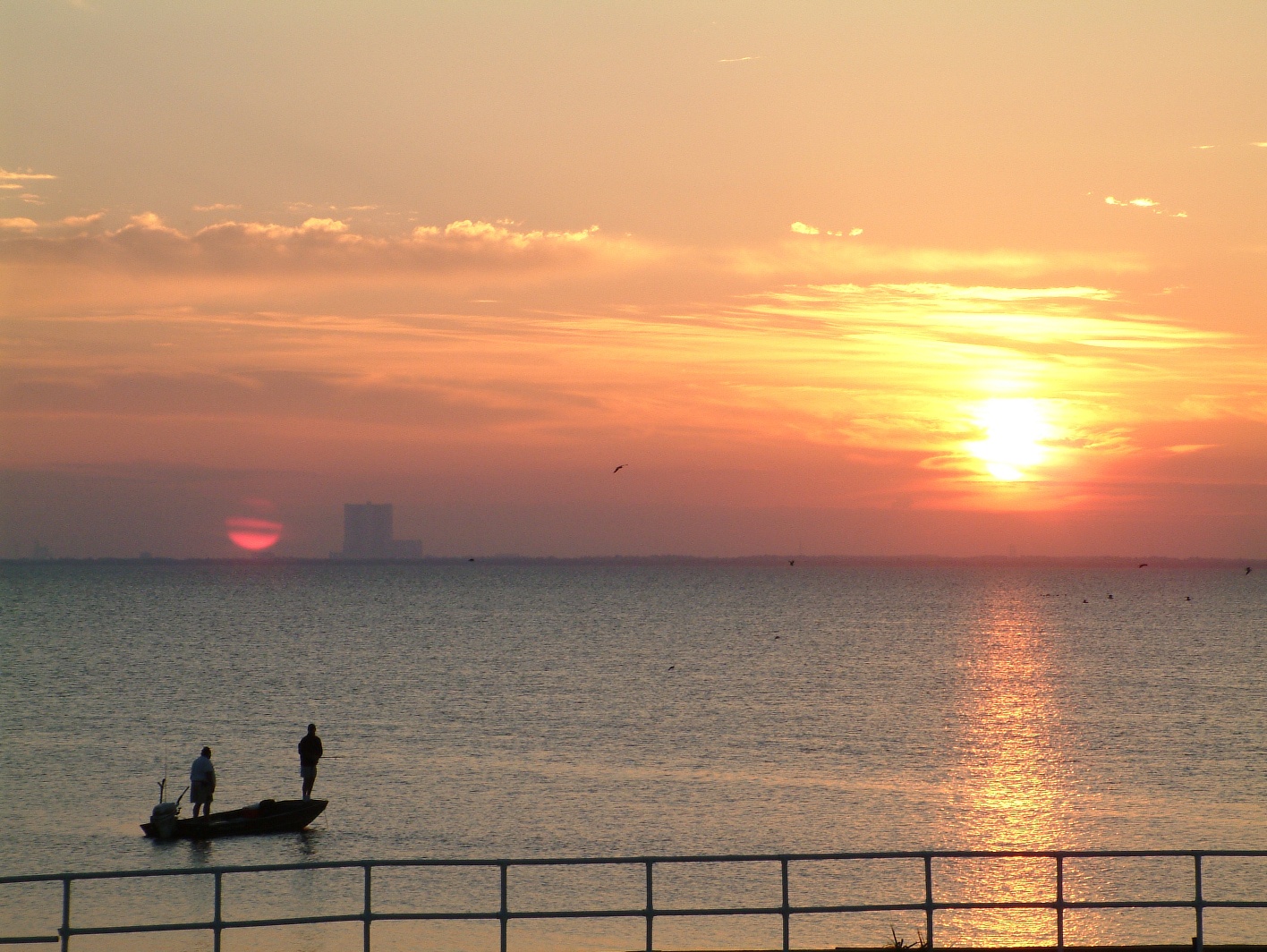
Firstly I use the opportunity to calibrate the altitude on my Garmin Instinct watch. I usually give it a go each month, just to make sure it’s working properly. While out near the forts I used the calibrate with GPS option and I got an altitude of -2m. Initially this confused me but then I realised that I was close to the sea but during low tide, therefore I was likely negative AMSL, so -2m seemed about right.
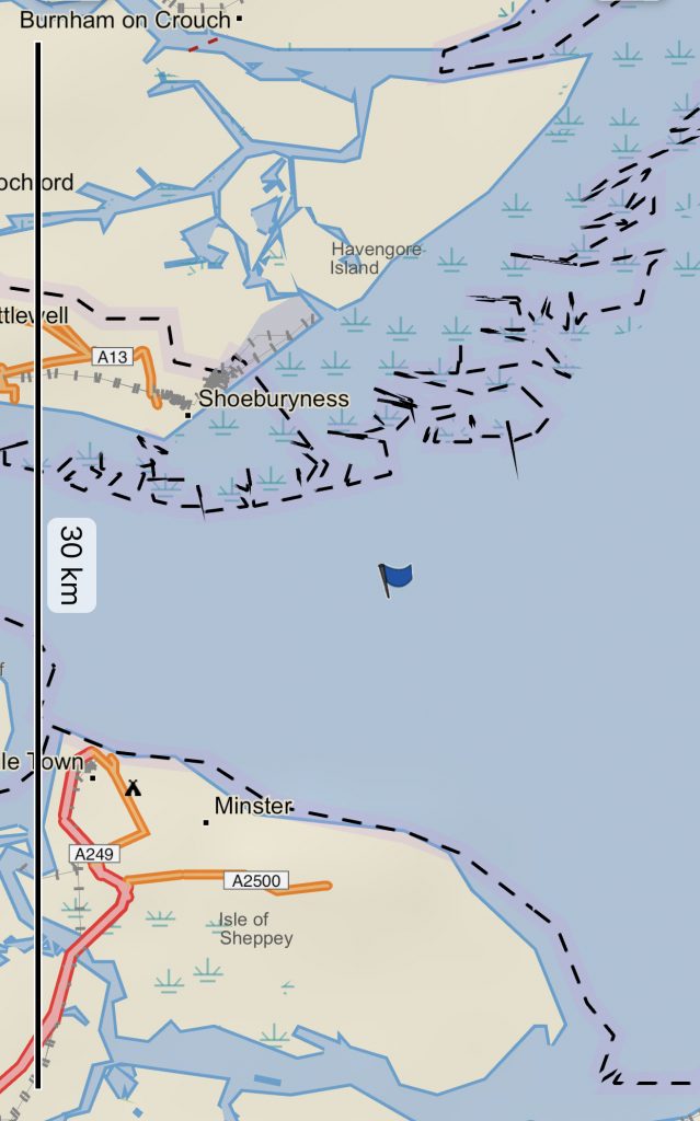
Garmin GPS
The above picture is my position as saved by the Garmin Instinct. I didn’t even know that was an option but I noticed it while I was calibrating the altitude. I saved the position and then was able to display it on my phone. There’s a Garmin app called Explore and I like the functionality.
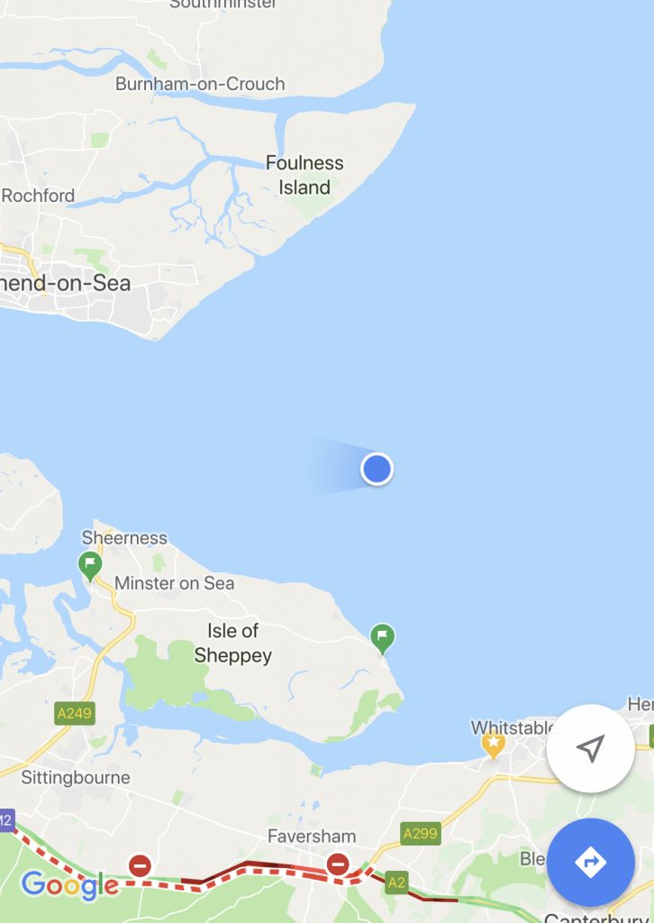
While out on the sea I also used Google Maps to see where I was.
iPhone GPS
I took this screen shot a bit before the Garmin one and so you can see I am slightly further east than the previous picture. I don’t think either of these was taken at the Redsands Forts complex as I was too busy watching.
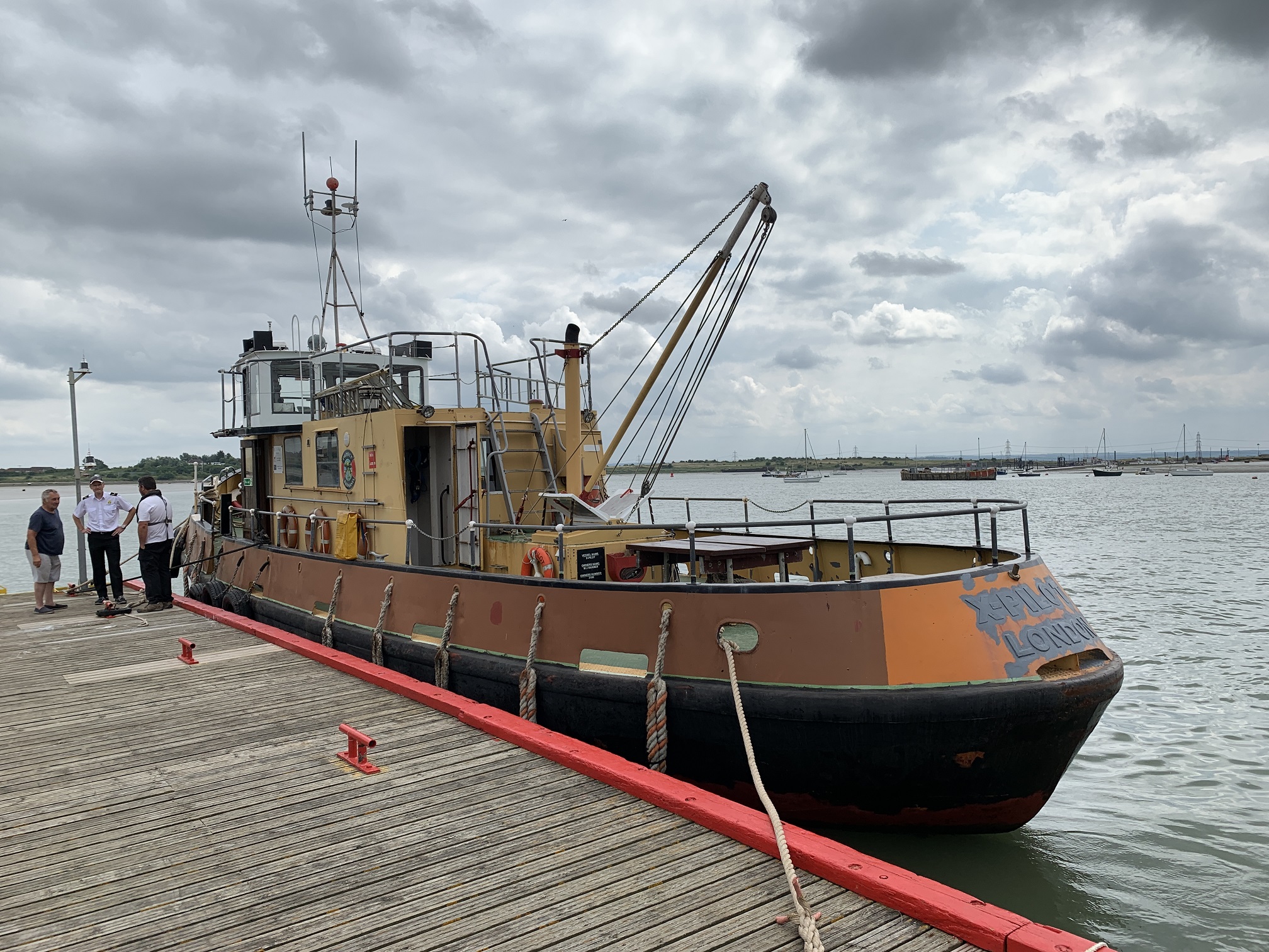
Yesterday I sailed out from Queenborough into the Thames Estuary to see the Redsand Forts. My ship fo rthe journey was the X-Pilot captained by Captain Chris, they weren’t worried with formalities. It was meant to be a four hour trip to see these abandoned aircraft defenses.
X-Pilot
After a safety brief the four passengers including me boarded the vessel and made ourselves at home. What really happened was we dumped our bags in the crew room and sat outside for the journey. The tide was waning, there was little wind, the skies looked kinda moody and the seas were slight. To make it a slightly more perfect trip it would have been nice to have glimses of sunlight for the photography but I was happy.
The boat departed Queenborough on the Isle of Sheppey and headed out past Sheerness to the Redsand Forts. These were built in the second world war to aid the anti-aircraft defenses of London. There are a few sets of Maunsell Forts in the estuary but I was booked on a trip to see just the Redsand ones.
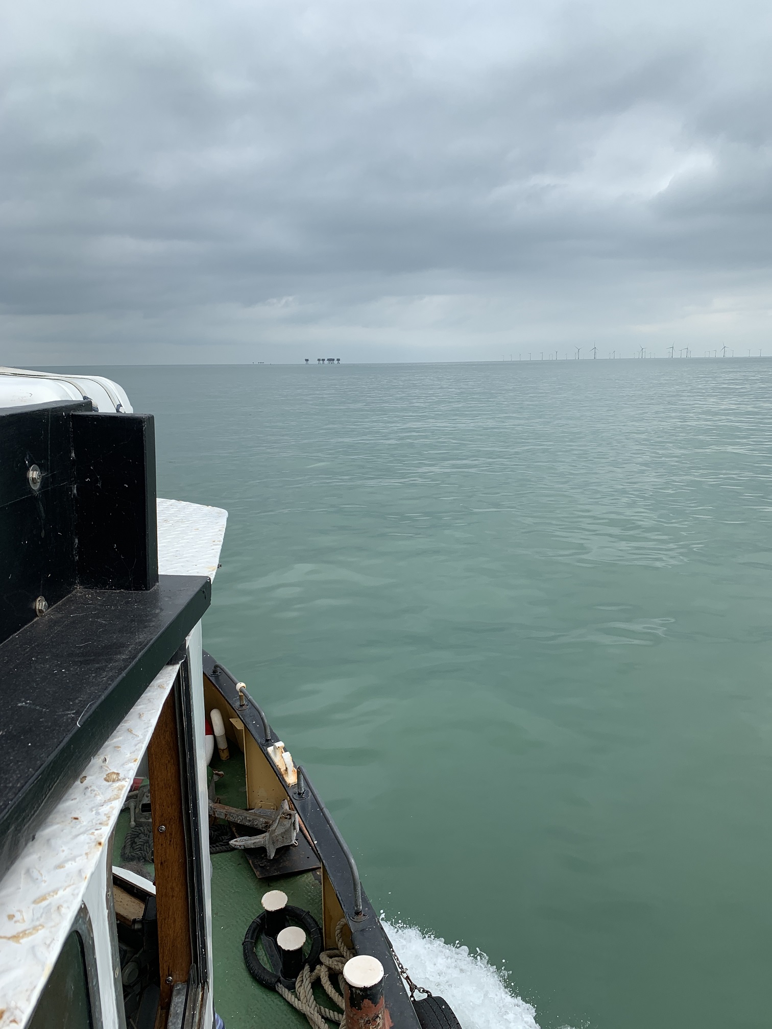
Approaching Aliens
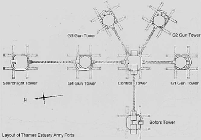
These forts were designed by Maunsell and towed out to the different sand banks in the Thames and sunk. They were crewed by over two hundred members of the army. There are pages about them on Wikipedia and the general Web. I won’t go into too much detail about their history in this communication because you’ll find much more information elsewhere, this is a good page.
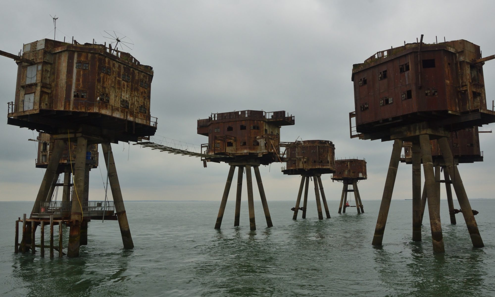
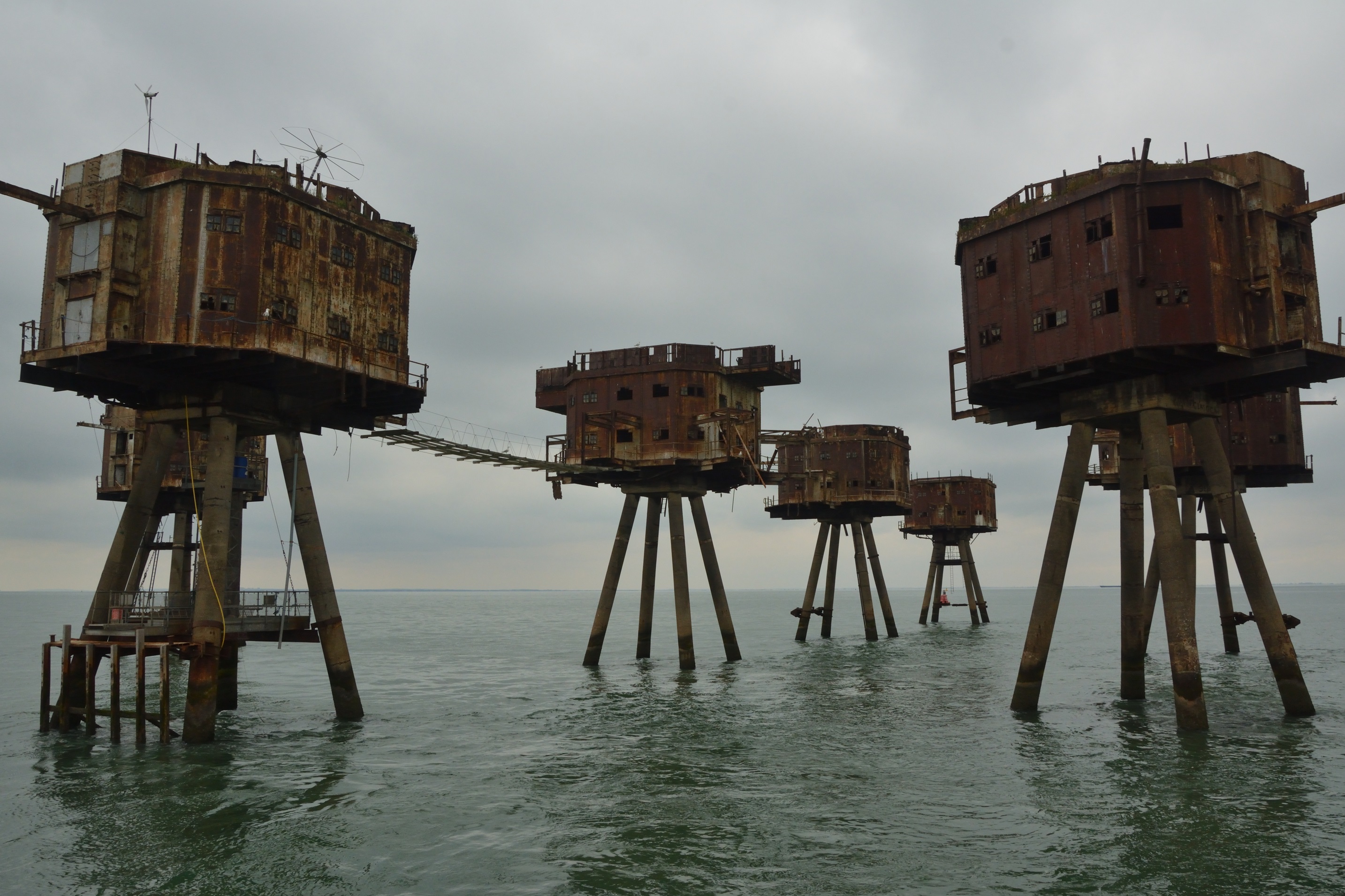
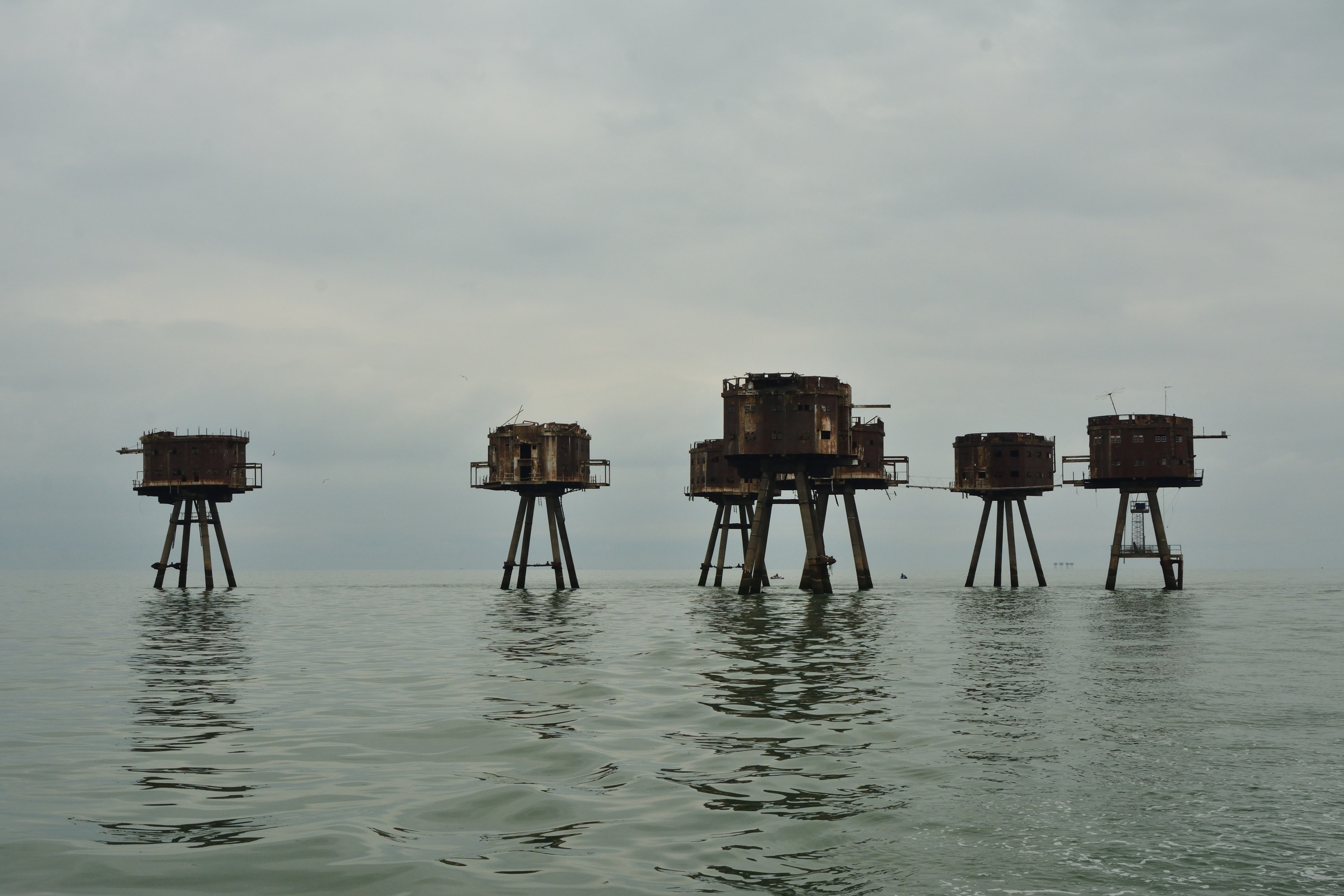
Redsand Forts
These beasts spring up out of the shallow waters and tower over the flowing sea to impress. They are such incredible structures. Four reinforced concrete legs followed by the I-pattern beams and metal walls. I do wonder how cold these were in winter! Most of the walkways are gone, can you imagine having to move from one to another?
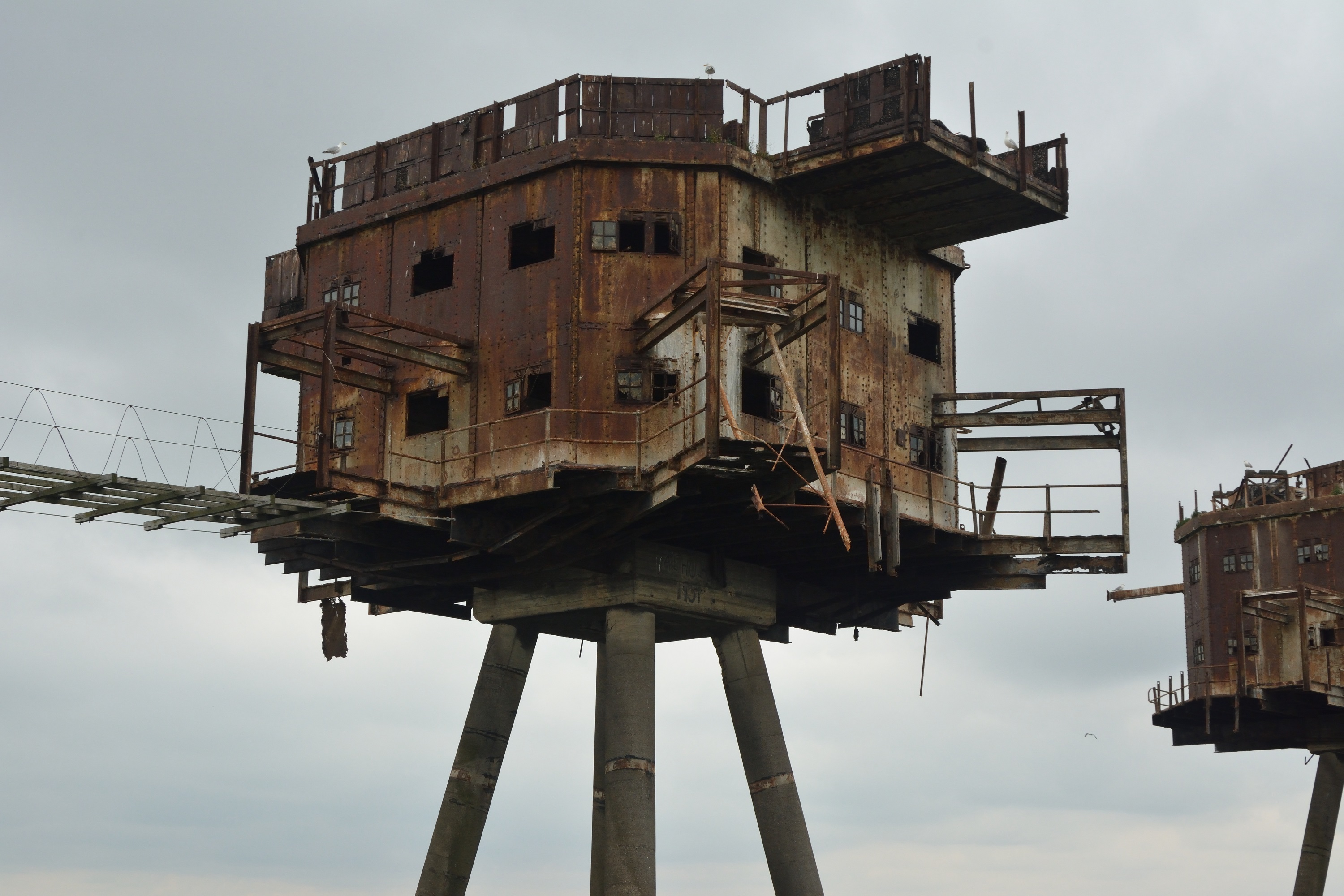
Roof Garden
In the above photograph you can see the two story structure and the roof. One of the towers is further away from the centre and I wonder if that’s where they kept the ammunition. It would be fascintating to see movie footage of these in use.
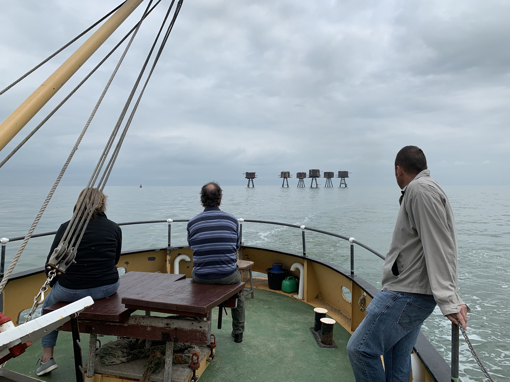
Redsand Forts looking like Martians
Above is my favourite photograph, I love the way the water looks so still and the towers look like little toys. I think we were lucky with the seas. As I said earlier, a few rays of sunsine breaking through would have made this a perfect photography day.
Departing the Forts
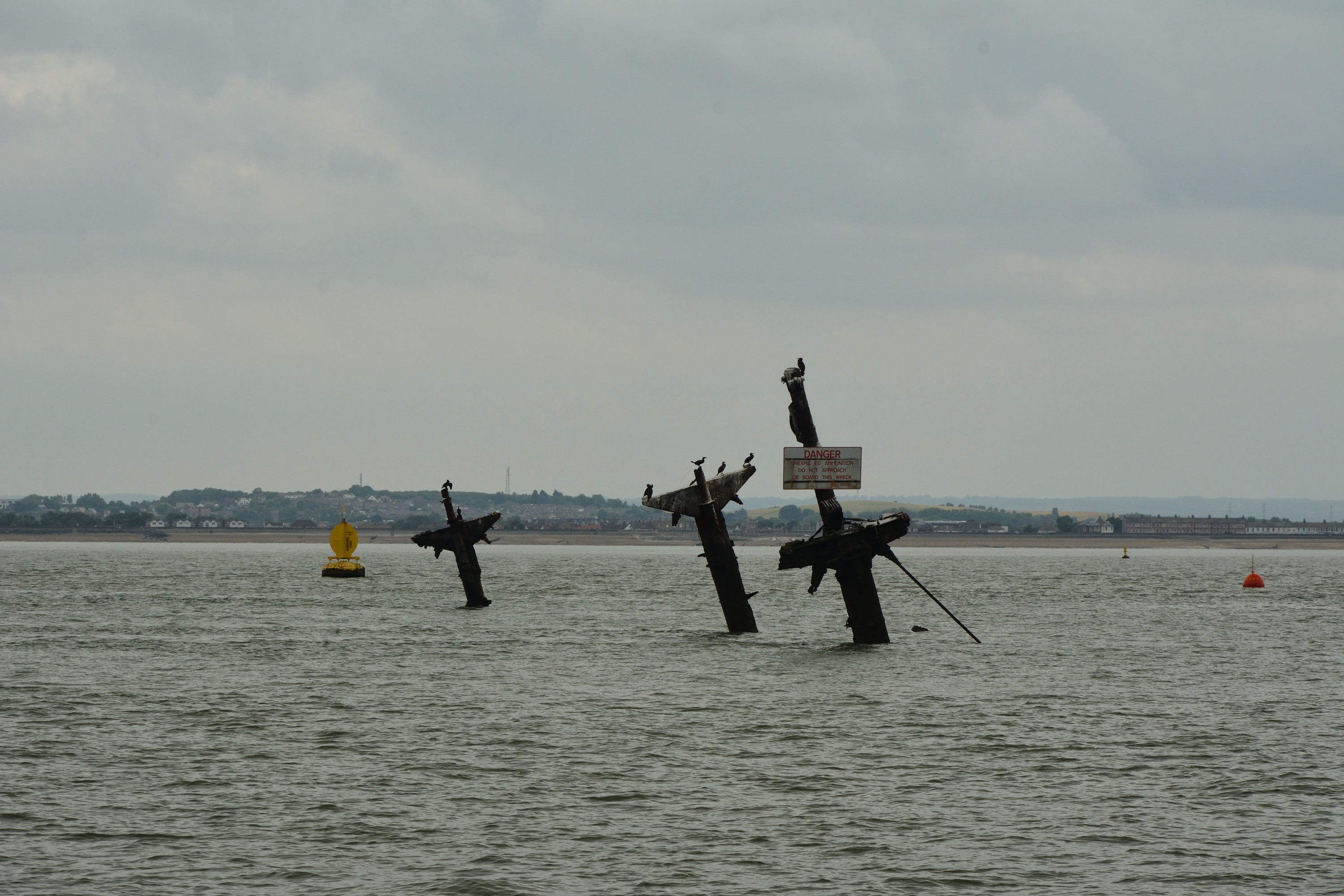
On the way back to port we passed around the SS Richard Montgomery. We had made good time out of the Medway because of the waning tide and so we had the chance to add to our excursion which meant a chance to encompass the ticking-time-bomb that is the Liberty Ship Richard Montgomery.
SS Richard Montgomery
You have to love a sign that says:
Danger. Unexploded Ammunition. Do Not Approach or Board This Wreck. By Order.
If it goes up there will be a massive bang, a huge cloud and plenty of water heading to the shores on both sides of the estuary. There are plenty of warnings around this wreck including yellow bouys, red bouys, signs and an exclusion zone on the charts.
This trip was great fun, a wonderful experience and very good value. I really enjoyed it.