Part of my recent trip to the Lake District was walking some new Wainwrights. I travelled up to Keswick for a week. I’m hoping to get back there later this year for some serious ridge walks and possibly ticking off another ten or so of the categorised mountains.
Derwentwater from the Ashness Bridge
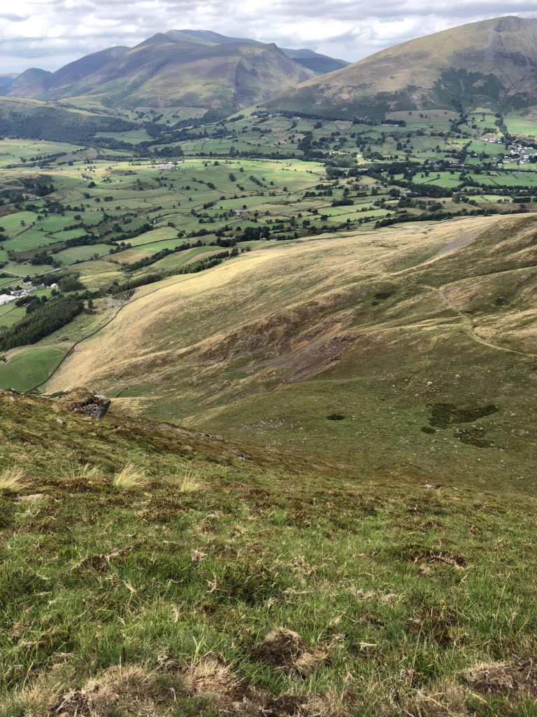
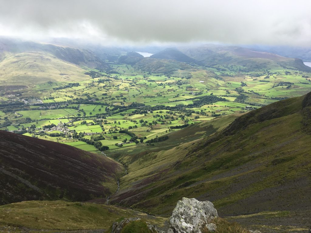
Just look at the gorgeous views you get from even half way up to high. This is the view from just above the Ashness Bridge.
Watendlath Tarn
If you keep driving or walking up the road from Ashness you get to Watendlath, a tiny hamlet high up in a hidden valley. It’s an amazing space and the tarn is lovely. This is just the sort of space you can imagine walking around a mini peak and finding people having sex, you know, the usual.
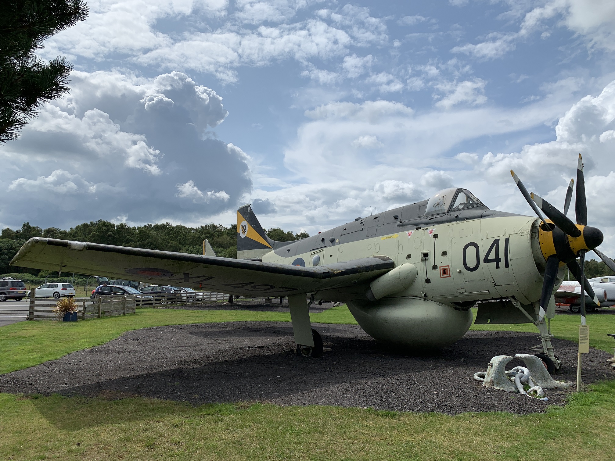
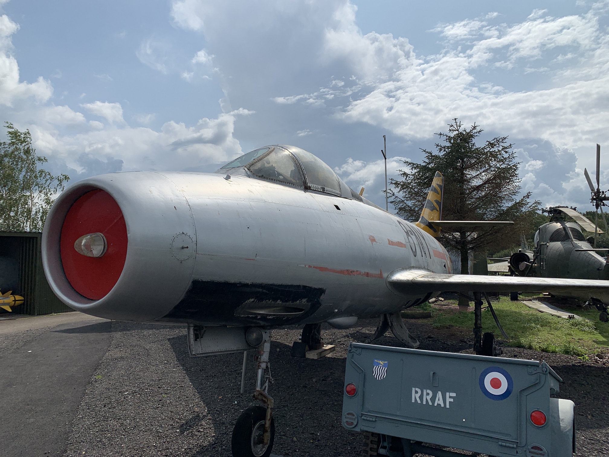
Hills and mountains can’t be everything and so it’s also important to see aircraft. I went to the Dumfries and Galloway Air Museum at the old RAF Dumfries. It was a curious place with planes looking rather dishevelled and in good need of a paint job.
Fairey Gannet
This one along with the Lightning was the best looking plane. There was a Saab Draken, a JP and a Westland Wessex, but they didn’t look great. The Dassault Mystere was doing OK.
Dassault Mystere
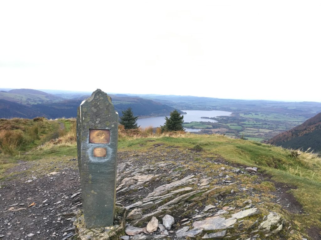
There needs to be a list of hills walked and their placing in the Wainwright list so here you are:
High Rigg [209 with a height of 354m]
Great Mell Fell [155 with a height of 536m]
Loughrigg Fell [211 with a height of 336m]
View From High Rigg
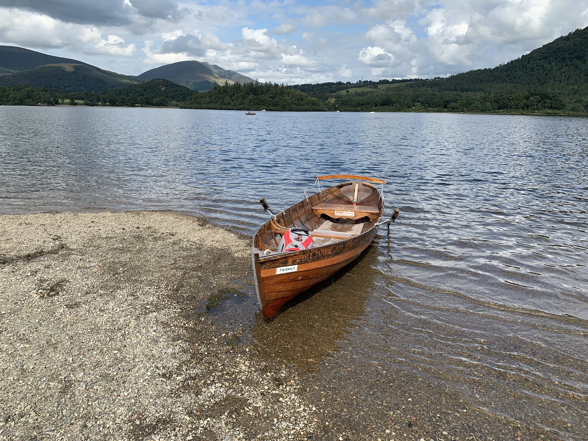
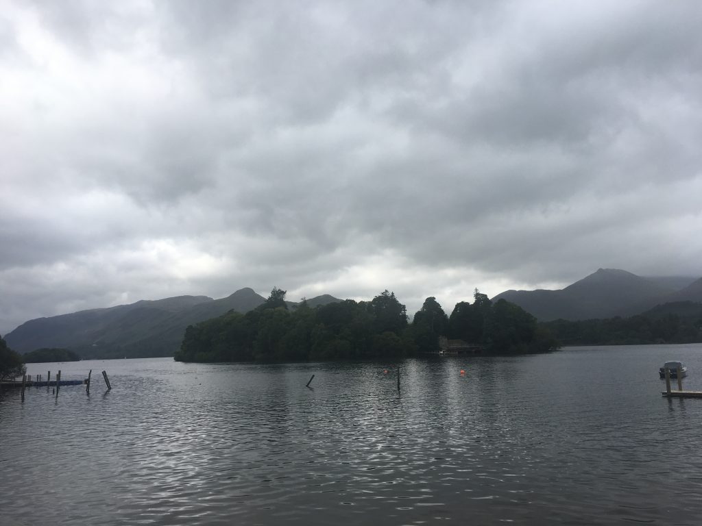
I did also walk Latrigg but this is about the fifth time I’ve done that one and so it shouldn’t really get a mention here. I did some rowing on two of the Lakes while I was there, Derwentwater and Grasmere.
Exploring Islands in Derwentwater
Keswick is a lovely place I think, maybe very slightly less so during Convention time because it makes it so busy and full of people, but still such a wonderful place to visit.
Grasmere from Loughrigg
Next time I’m up here in the summer I think I would like to go swimming in the Lakes. It looked very inviting and paddling wasn’t that satisfying. I’d rather be out there adventuring. I think my swimming is good enough. I’m not fast but can keep a steady pace going, much like my running. I can’t wait to get back up to the north west again.
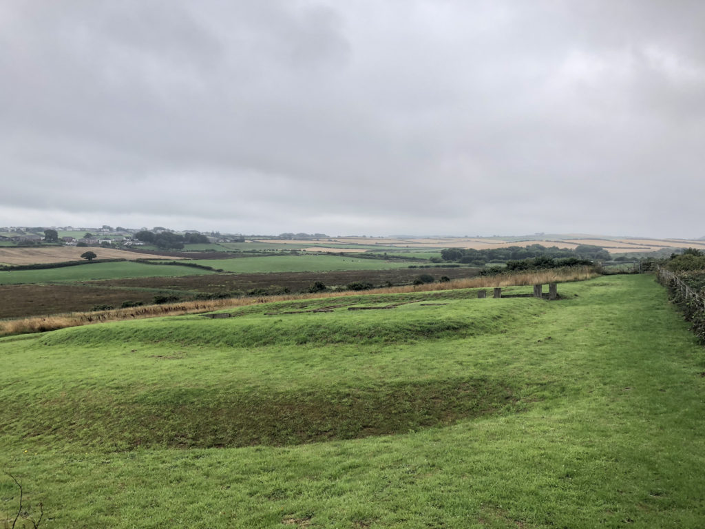
While the second day in the Lake District was spent wandering around Maryport on the Cumbrian coast I did learn a reasonable amount about the Romans in Britain. The weather while there was pretty poor with low visibility and often rain.
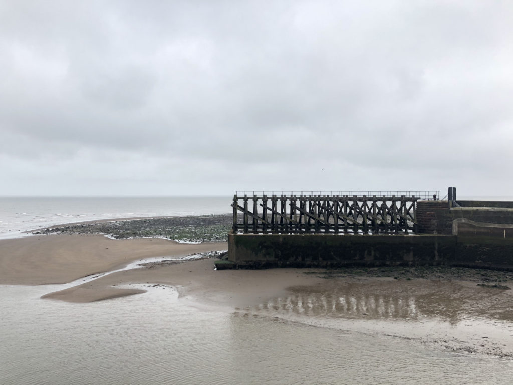
Maryport Harbour Wall
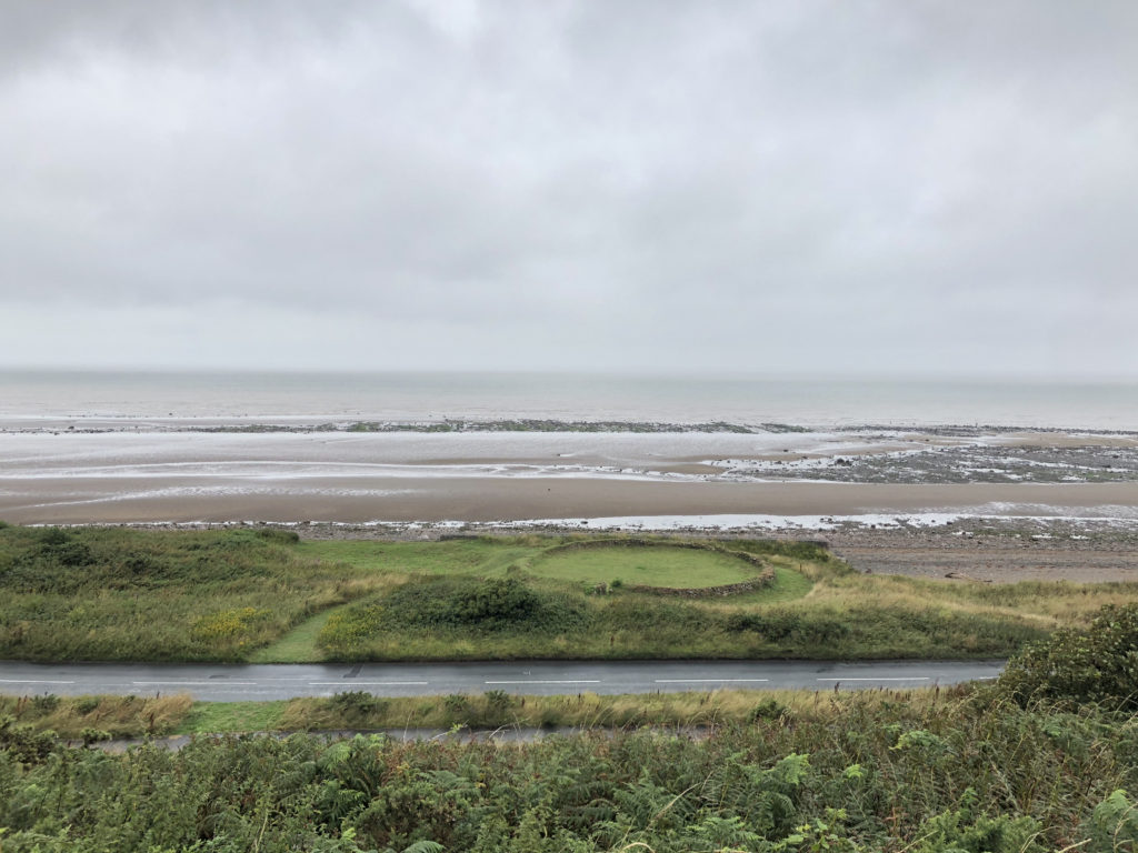
I visited the Roman museum there and I was going to visit the town’s museum about the sea and fishing but it’s one of those museums that only opens on even numbered days or something like that. There is, nearby, the only discovered remains of a Roman Milefortlet which was a fort placed every Roman mile along the coast to protect the country.
Roman Milefortlet 21
There was also the remains of a salt pan from medieval times.
Salt Pan
All fish and meat was preserved using salt and much of that salt came from pans like this where the water evaporated leaving the sea salt. This is much like the process used in Maldon. Later that day I drove back to the campsite via Buttermere and the wonderful cake and ice creams that are served there.
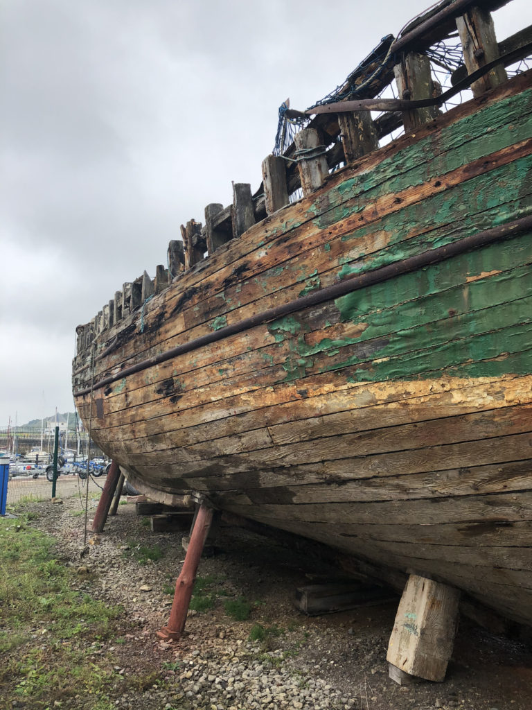
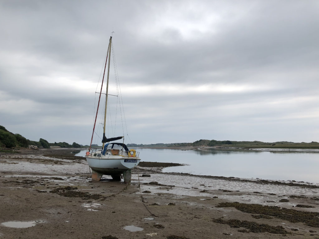
Maryport Boat
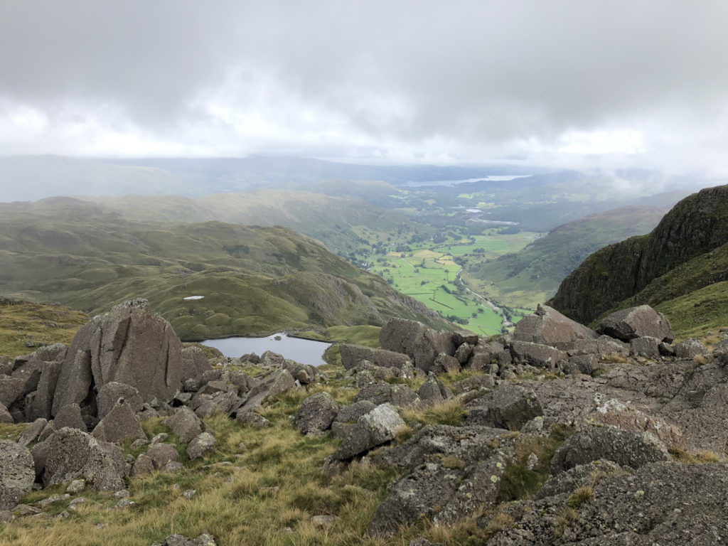
So, my last full day in the Lake District was going to be walking more fells. I decided to try and complete the Langdale Pikes. These are quite close together so once up at height it should be easy to get around. That is if the weather was clear. I started my walk later than normal because the weather was due to clear after midday [it was more like 15:00 but you know, they can’t get it correct all the time]. It’s also worth noting that the temperature at altitude is lower than that in the valleys. So, around 600m up the temp was around 12C rather than the 20C in the valley, along with wind this means clothing must be carried.
I took a route up from the New Dungeon Ghyll hotel up along Mark Gate towards Loft Crag. My first stop was at Thorn Crag, which is written on the map a little way off from where it is and I used a second app on my iPhone for working out where I was with more accuracy. Pretty much all the while I was at the top I was in cloud. This only abated after I had spent a little time at High Raise.
So, here’s the list of fells and pikes reached and where they figure in the Wainwright list:
Thorn Cragg [not on the list]
Loft Cragg [number 93 by height – 2270 ft]
Pike Of Stickle [number 83 by height – 2323 ft]
Harrison Stickle [number 71 by height – 2403 ft]
Pavey Ark [number 88 by height – 2288 ft]
Thunacar Knott [number 77 by height – 2351 ft]
High Raise [number 57 by height – 2500 ft]
Sergeant Man [number 69 by height – 2414 ft]
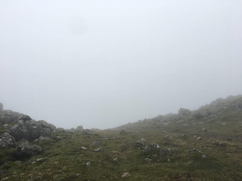
A couple of things stick in my mind; rock climbing up to the top of Pike Of Stickle which was fun but only because I missed the footpath by about three metres. The footpaths were not clear to me at the top an I did a lot of dead reckoning about taking bearings etc. The cloud didn’t help much either. Whenever there was a break in the weather I tried to look for footpaths and remember where they were going.
View From Pavey Ark
Eventually when I got back down the mountains it was much later than normal for me. I try to walk early in the day to give myself time in case things start going wrong but the weather forced me to walk at a particular time.
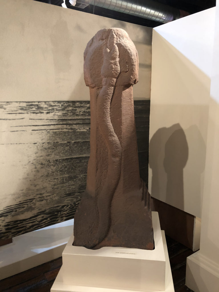
Finally I leave you with a picture of a Roman article. I mean, it’s a penis isn’t it?
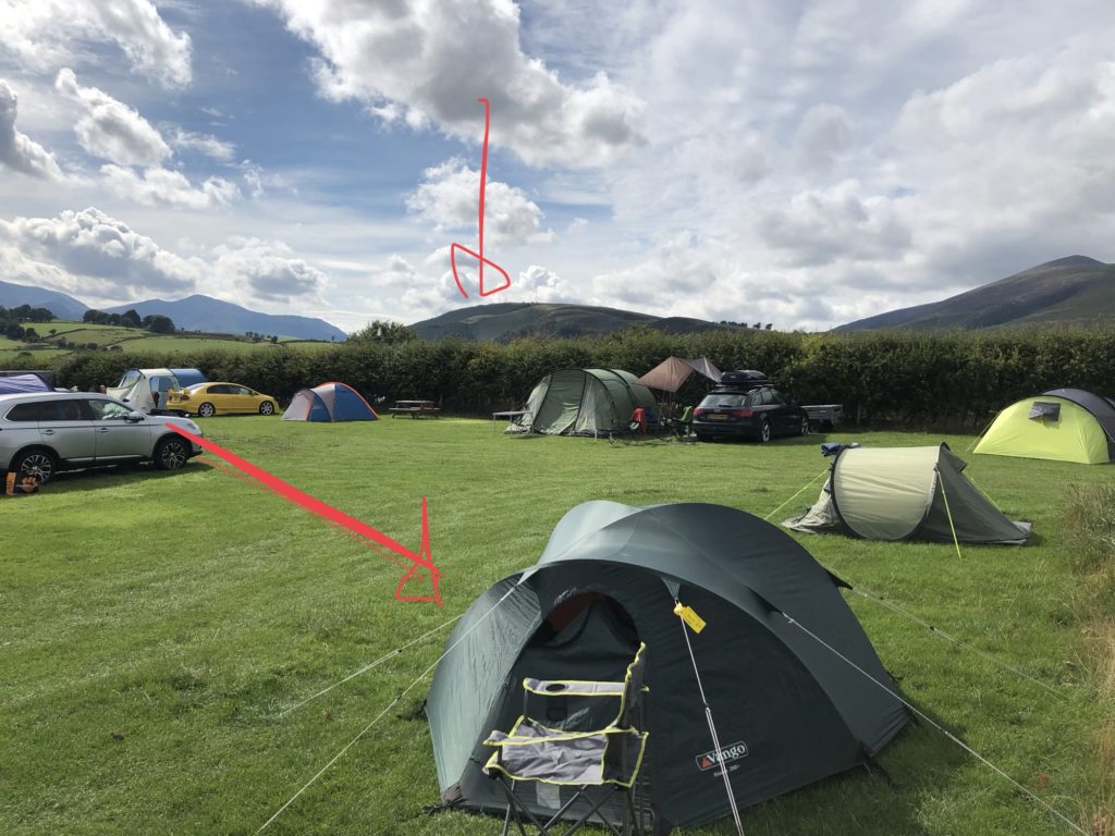
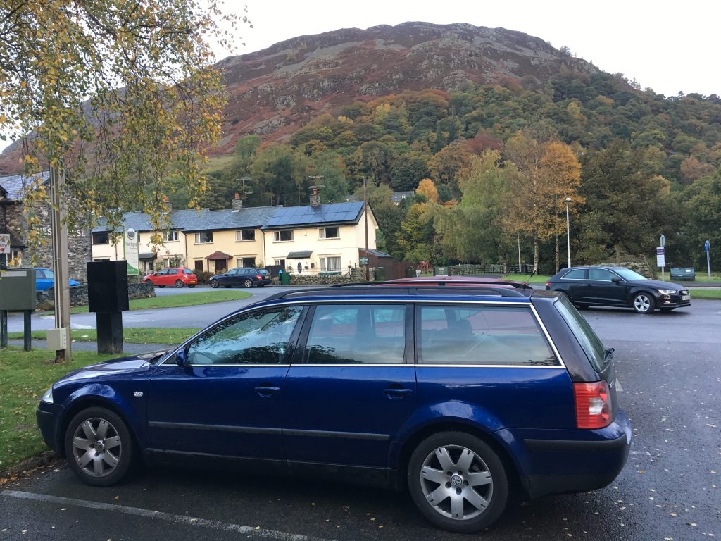
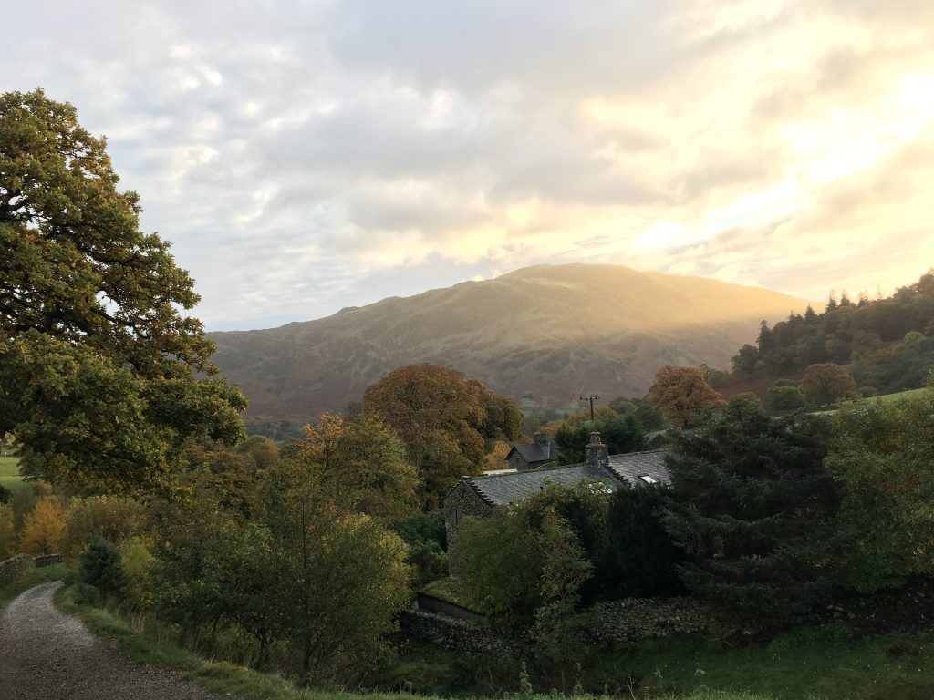
Just over a week ago I drove to the Lake District to spend some time camping and walking. My main objective was to escape the 30C heat in the South East and replace it with more normal 20C temperatures in the mountains, well, in the valleys anyway. I camped at Burns Farm camp site and it was well sited, within the peaks of Latrigg, Blencathra and Clough Head.
Burns Farm Campsite
In this picture you can see Latrigg and my tent highlighted with arrows.
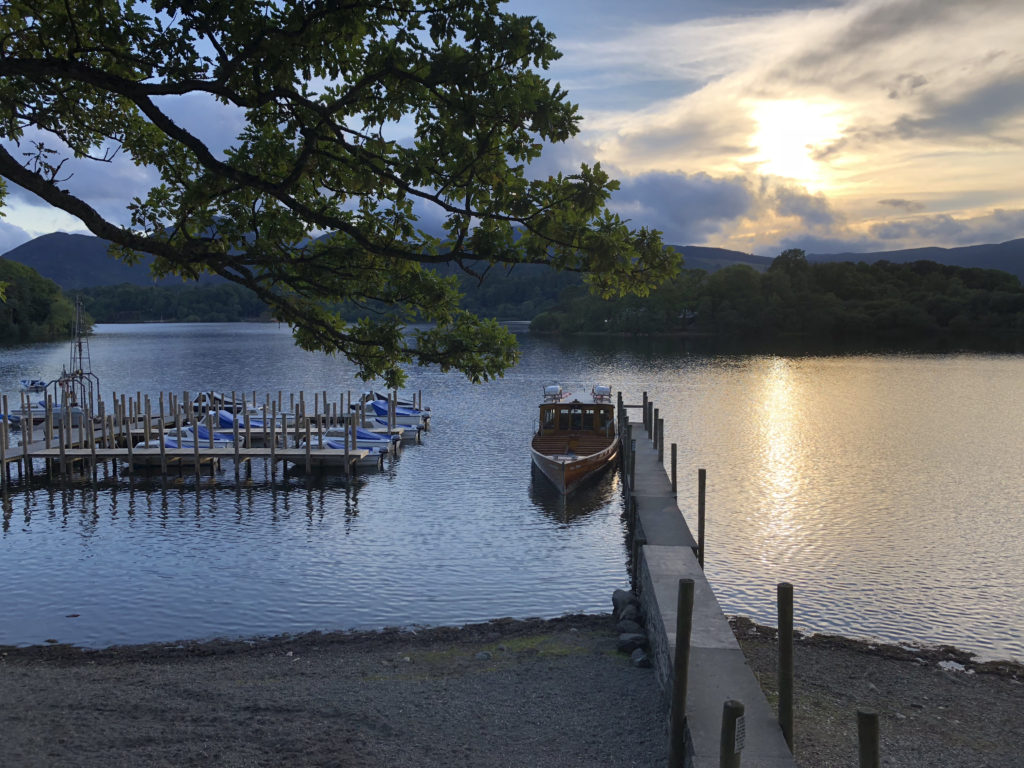
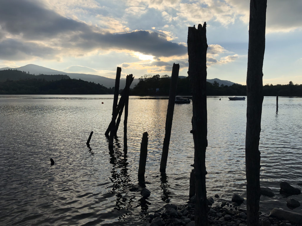
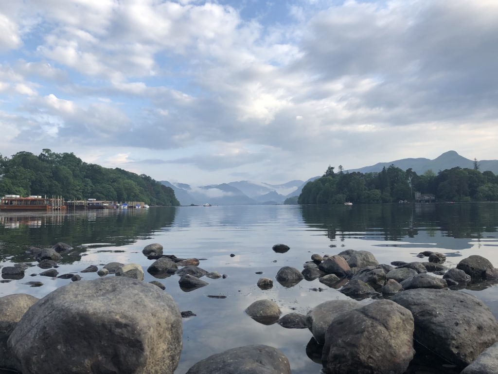
That first night I drove up to the Under Skiddaw car park and walked the little way to the top of Latrigg. It’s nice to see the lakes from this angle and gaze down on Keswick. Then I drove into town and walked along the banks of Derwentwater. It is so easy to take gorgeous photos of this lake in the sunset.
Derwentwater
So, on the Sunday I got up and made coffee in my new cafetiere I bought solely for camping trips. The coffee was nice. The previous day I had checked out parking spots for my Sunday walk and I had decided to park at Thirlmere village hall car park where the parking was £2 for the day and the footpath I was planning to use started at that spot. When I got there on the Sunday though there was a notice up saying that the car park was being used for a private event for two days. So I headed 500m back and parked at Legburthwaite Car Park which turned out to be free!
I headed up the mountains via Stybeck Lane and then up towards Brown Crag. Brown Crag isn’t an official Wainwright Fell and so while pretty it doesn’t count towards my total.
From there I walked up towards Whiteside [number 84 by height 2317 ft]. From there it was a reasonably simple ridge walk to the following listed mountains, I used my walking poles for the first time and I found them useful for the open trekking rather than steep climbs.
Raise [number 12 by height 2889 ft]
Stybarrow Dodd [number 21 by height 2770 ft]
Watson’s Dodd [number 40 by height 2584 ft]
Great Dodd [number 19 by height 2807 ft]
Calfhow Pike – not on the Wainwright list
Clough Head [number 74 by height 2381 ft]
I wasn’t sure I was going to complete the last two peaks because there was a very long walk back to the car if I completed those. As it was I chose to do them anyway and the walk back hurt but was nice and fun.
The view from Clough Head was quite stunning.
View From Clough Head
There were two choices for the route down Clough Head, one along a very clear footpath [when seen in satellite view] and one down a steep scree path which is much steeper but shortens my walk back by some distance. After chatting with friends I chose the red scree path and it was fine. It was quite steep and thin but it was easily passable. In the picture above you can see a little of the bottom part of the path.
Once I got back to the car I drove the short distance to The Lodge In The Vale and had a lovely Persian cake with a cup of tea. It was very much deserved.
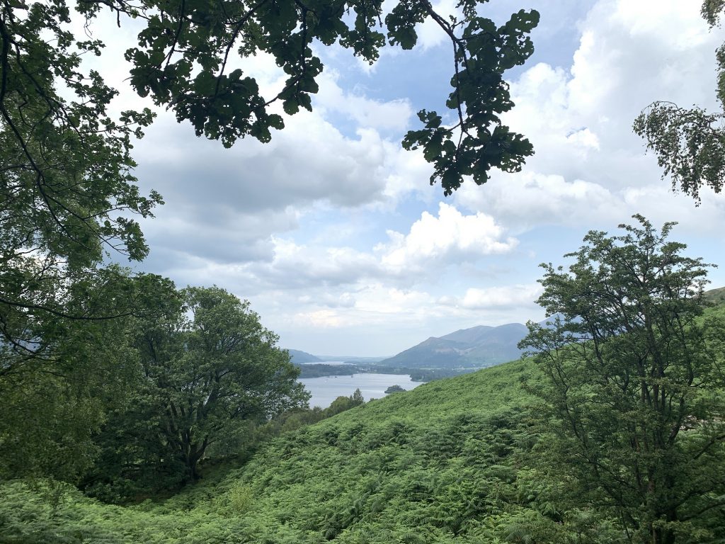
Over half term I made the journey to the other end of this country to spend some time in the Lake District. While it is quite a drive the views and atmosphere are so worth it.
While in the district of Allerdale I decided to complete a few more of the Wainwrights. There are 214 fells mentioned by Alfred Wainwright in his books and I’ve got a taste for bagging some each time I go to the Lake District. My personal target is to complete the lot by the time I am 60. I’ve got 14 years to go. I need to up my rate a little but the next time I go I am planning some lovely ridge walks that should get quite a few crossed off!
On the first day I went up Walla Crag [number 204 by height].
I parked in Great Wood car park and walked up the Cat Gill route and down again via Castlerigg. It was a lovely little jaunt. Now I had a feel for it I wanted to try and get some of the lower stand-alone fells bagged. I was trying to cross off those that would mean a big detour on future longer routes so this would allow me to make as yet unplanned walks easier.
Next was Binsey [number 192 by height]. A little mound of a fell on its own to the north east of the Skiddaw range.
This was too easy. The car was parked about half way up and was really just a little stroll. The views from the top were amazing. It was a lovely warm and sunny day with visibility running at about 25km. The mist was so fine that I couldn’t see the Scottish peaks but could just see Scotland across the Solway.
Derwentwater Withies
Another day, another walk. This time up Cat Bells [number 189 by height]. I had already completed this particular fell and so wasn’t too fussed about climbing it but I had planned to meet a work friend there.
It was pretty busy at the top and plenty of people were making this their first Wainwright. I t was nice to see so many people enjoying this countryside. The views are just lovely.
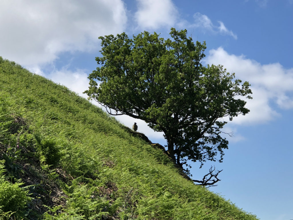
Walking down Catbells and I saw this sheep just standing and staring.
The Hills Have Eyes
The next day was a rest day and I went on a narrow gauge railway and then visited Muncaster Castle. The walk back took in a short distance by the river Esk. The air was so still that the water looked like a mill pond.
River Esk
I drove back to Keswick through two mountain passes. One was Harknott pass and this is a most ridiculous road. There are hairpin bends with a gradient of 1:3. There were times I couldn’t see where the road went out the windscreen while turning because the road dropped away so fast. It was a very satisfying drive. Then, there was the Wrynose pass which wasn’t as spectacular but was still very pretty.
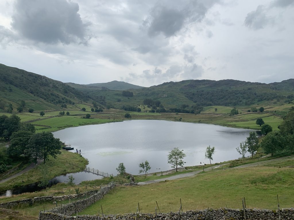
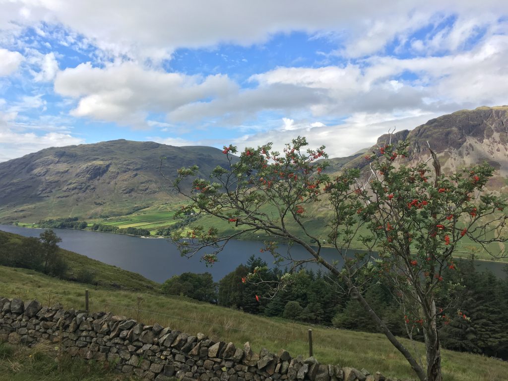
Another rest day followed with a lovely time doing various things together with going to watch Solo. The final walk day was spent hanging around Crummock Water after getting to the top of Rannerdale Knotts [number 210 by height] adjacent to the lake.
I’m annoyed that I forgot my hat. I don’t do well in direct sunlight, I have a lack of natural head covering, not that I’m too fussed about that, and I burn easily, even with sun lotion on [SPF 50].
Crummock Water
That was it for the week. A journey back to the South East and good broadband bandwidths beckoned the next day. It was good to get back to upload speeds in excess of 0.4Mb/s, it was needed to chuck photos into the cloud.
The Lake District has now joined Hildesheim airport as a place I can go to clear my head and achieve things. This summer I drove up there to Keswick. I didn’t have many concrete plans on the way but did know I wanted to bag a few more Wainwrights. My attempts on these fells was weather dependent and so the first day seemed more appropriate to visit parts of Scotland I missed out previously.
The day started with a small walk up Castle Cragg. This is the smallest of the Wainwrights and number 214. It’s not even a mountain being slightly less than 1000ft, but it is 300m which makes it ok?
Castle Crag looking SE
While driving to Portinscale the surface of Derwent Water was lovely and smooth and an almost perfect mirror.
Derwent Water
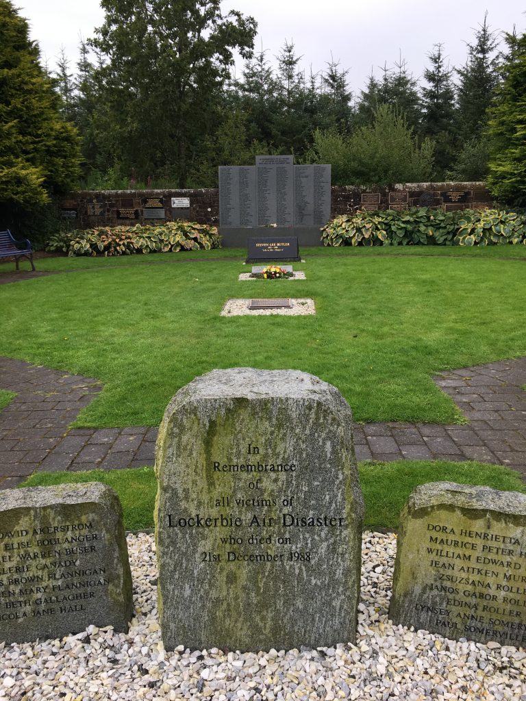
As the weather wasn’t meant to hold out all day I then headed to Scotland to see some things that had been recommended to me the last time I was in the North. I drove to Lockerbie to see the memorial to the people who died in the Pan-Am 747 bombing in 1988. While on the way I saw a sign for the Ukrainian Prisoner Of War Chapel, I turned to follow these signs but when I got there the place was closed. Which was a shame, I had expected to learn some snippets of history about which I was unaware.
Lockerbie
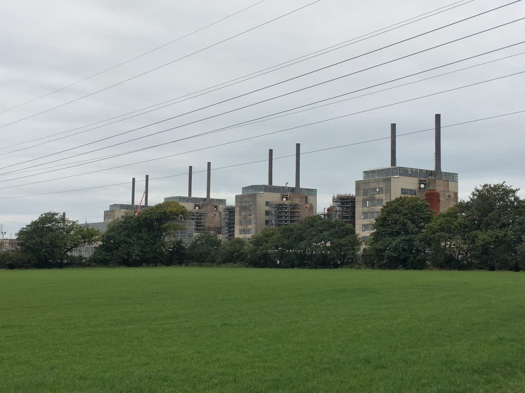
From Lockerbie I drove to Eastriggs and the Devil’s Porridge Museum. This museum had been recommended to me when I was at Carlisle Airport and I have to say it disappointed. It was housed in a new building and very lovely and all that but it just left me feeling a bit “meh”. I had lunch there, which was perfectly fine, but the museum itself just lacked something. I’m not sure what. I did learn that pretty much the entire coastline from Gretna to Dumfries was used to produce explosive during the first World War. After the second World War the area was used to produce plutonium for the UK’s nuclear bomb effort. It was the decommissioning of this Chapel Cross powerplant that I witnessed.
Chapel Cross
On the drive back to Keswick I drove past the Skelton radio transmission station. It has the UK’s tallest structure and is used to transmit VLF signals to the UK submarines.
A big day now awaited me. I planned an assault on the top two mountains in England. I had chatted to experienced fell walkers and planned pretty well. I got up early and drove a crazy route to Wasdale Head at the end of Wast Water. I grabbed a coffee-to-go in the village shop in Gosforth and got ready for the day’s walking. The main plan was to get up to a saddle near Scafell Pike, decide whether to skip up to Lingmell and then go up Scafell Pike and Scafell. There were plenty of opportunities to remove myself from the mountain along the way if I felt not sure.
Lingmell Summit
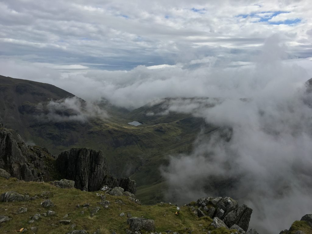
Lingmell [number 29] was pretty simple to walk from the saddle and the whole world looked very desolate and calm, almost at peace with itself. Mind you, Sellafield was looming in the distance. I climbed the rocky barren waste of Scafell Pike [978m] [number 1] and at that point was higher than anything else attached to the earth within England. It was while up here that I looked SW and saw a blanket of cloud.
Scafell Pike Summit
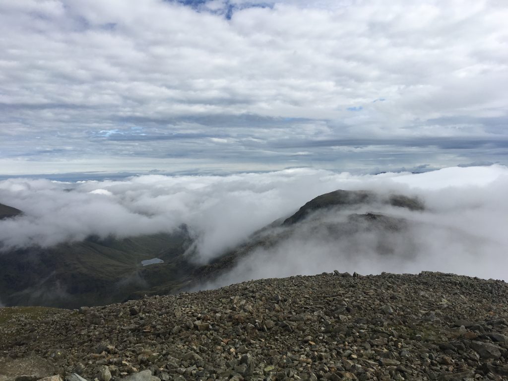
I was above the majority of the clouds and was a little worried about visibility. I managed to get to Mickledore and I wasn’t too happy with the conditions but I met another chap who was heading up Scafell and so we joined together for the waterfall climb up to Foxes Tarn and then Scafell [964m].
Scafell Summit
Scafell [number 2] was encased in cloud and I couldn’t see a great deal. After lunch I headed down by a westerly path and headed towards Burnmoor Tarn. It was a very pleasant walk back to the car park.
Wast Water
It’s nice to see trees and colour again after you’ve been “at altitude” [I’m def not serious there]. I had a cup of tea at the Wasdale Inn and then returned to Keswick via the same stupid road. It was single track, hilly and had sheep everywhere. It was also used as a rat run by locals on their way to or from work.
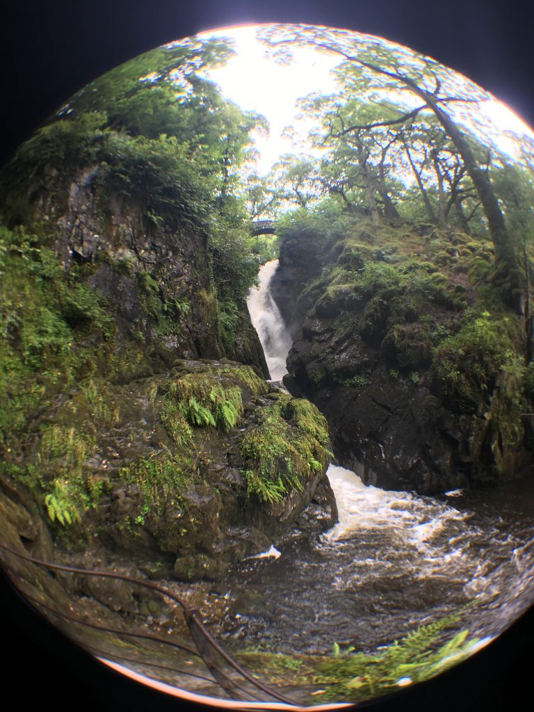
The next day was a rest day. Although, I would say that I’m definitely getting better at this hill walking lark. I felt good and could have climbed again. But I had plans. I went to see Aira Force waterfall, I have no idea how to pronounce the first word. I don’t care. It was a short walk from the car park next to Ullswater to the waterfall. It was quite an impressive sight, as it had rained overnight.
Aira Force
It was very green at the waterfall. Very pretty. I then met some work friends in Bryson’s tea room in Keswick. It was nice to chat and catch up. I don’t think we spoke much of work, which is a good thing. After that I bought my Scafell Pike mug and headed to Cockermouth to see what it was like.
Wordsworth House, Cockermouth
The rivers through Cockermouth were quite impressive, they were flowing steadily through the town. No wonder it flooded terribly recently. I visited Wordsworth House, where the poet William was born. It was reasonably interesting. However, the fact that the flood waters were marked almost at head level made me very impressed with how the town had tidied up. I had lunch at Beatfords tea room. That evening I had dinner with Penguin and Mrs Penguin at the Inn On The Square. They sat us around the corner and out of the way as we were dressed quite poorly for such a lovely looking restaurant/hotel place.
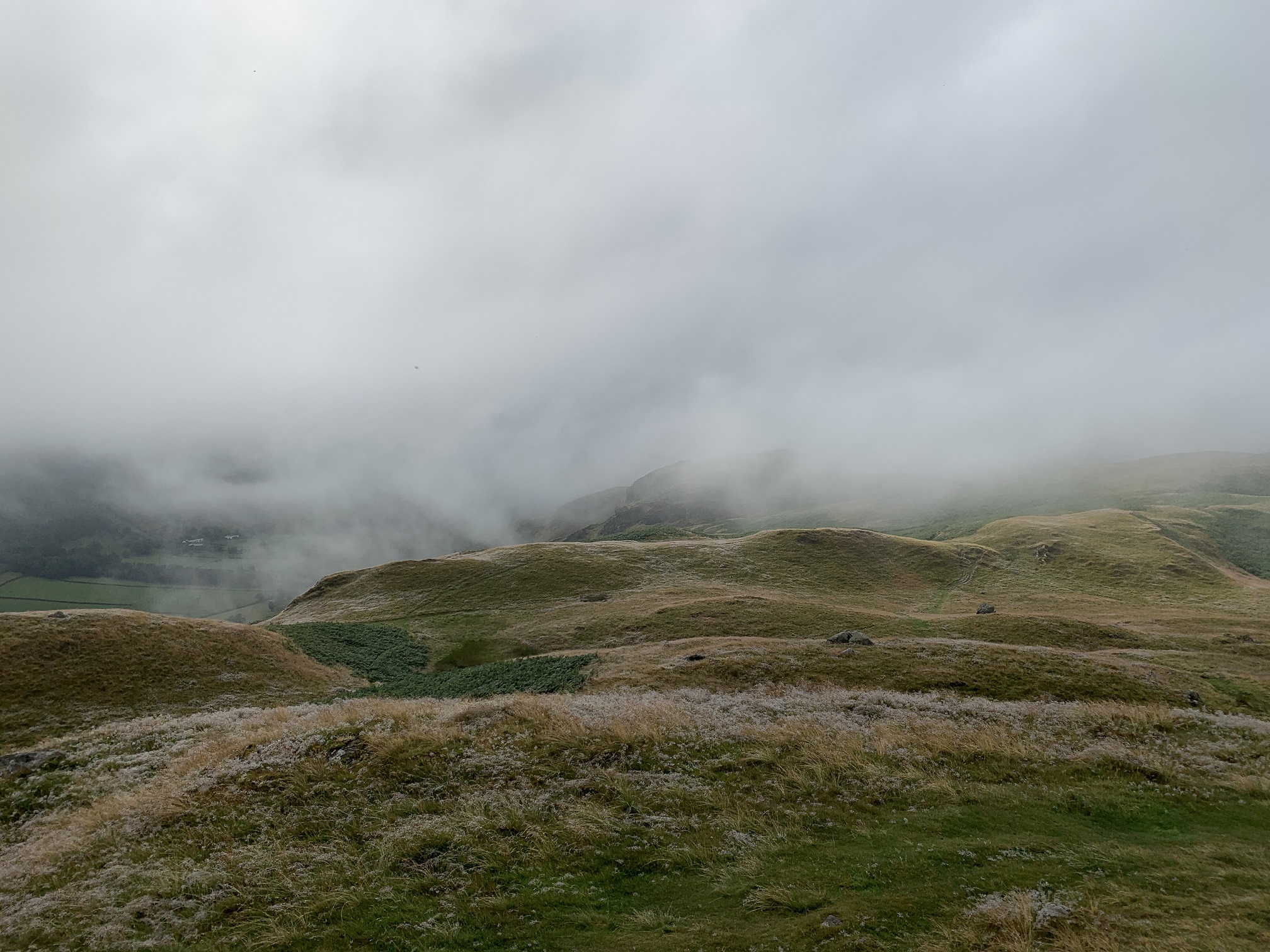
On my last full day in the Lake District I decided to conquer Blencathra. I parked nice and early in Threlkeld and walked to the NE end of the mountain. My plan was to climb along Sharp Edge but when I came around a corner and saw it looming, sharp and in fog, I decided “screw that” and just headed up the rather plain and boring ridge route to Blencathra [number 14] and the other two prominences. The views were stunning. It was a shame about the clouds, but the sun shone through breaks and the rain showers drifted over the valleys. Utterly gorgeous.
Blencathra
On the way down I completed part of a Whatsapp! annual challenge and enjoyed the views as I descended into the valley towards the A66 and back to my car. There’s a certain level of clear headedness that comes from being on your own in the mountains. I really love it and am starting to think that I might actually be ok at this fell walking stuff.
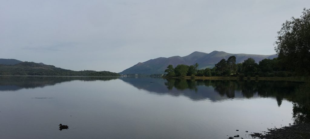
On my last day in Keswick I breakfasted at the Filling Station Cafe and then wandered to the Lake side as I hadn’t been there so far and I enjoyed the wander through town.
Lake View
I was now heading to Bradford for a music festival. The traffic on the A66 was terrible after an accident so I took the scenic route to Kendal and then across Yorkshire to Bradford. It took two hours, but was a nice drive.
This is another in the occasional series of mountains conquered. On a Sunday morning I awoke and headed out from Keswick to Dodd Woods to the east of Bassenthwaite Lake. This peak is a western foothill of Skiddaw range and not too high at 1612 feet or 491 metres which makes it number 174 of the Wainwrights.
This peak had a very clear footpath all the way and was a nice little walk. It is one of the last strongholds of the red squirrel and a good vantage point to see ospreys of the feathered kind when they are in this country.
View from near the summit of Dodd with Derwentwater and Bassenthwaite Lake
There’s a monument at the top of Dodd to two scout leaders.
On 28 October I decided, after reviewing the weather, that I would attempt to scale Helvellyn the third tallest mountain in England. By attempt I mean that I would either get to the top or turn around very quickly, there aren’t that many escape routes. I parked the beast in Glenridding and check my equipment. Then I sauntered purposefully towards Mires Beck. I had planned to contour around Birkhouse Moor but in retrospect I shouldn’t have because I will need to head back there to complete that fell.
The Beast At Glenridding
View from the path up to Mires Beck
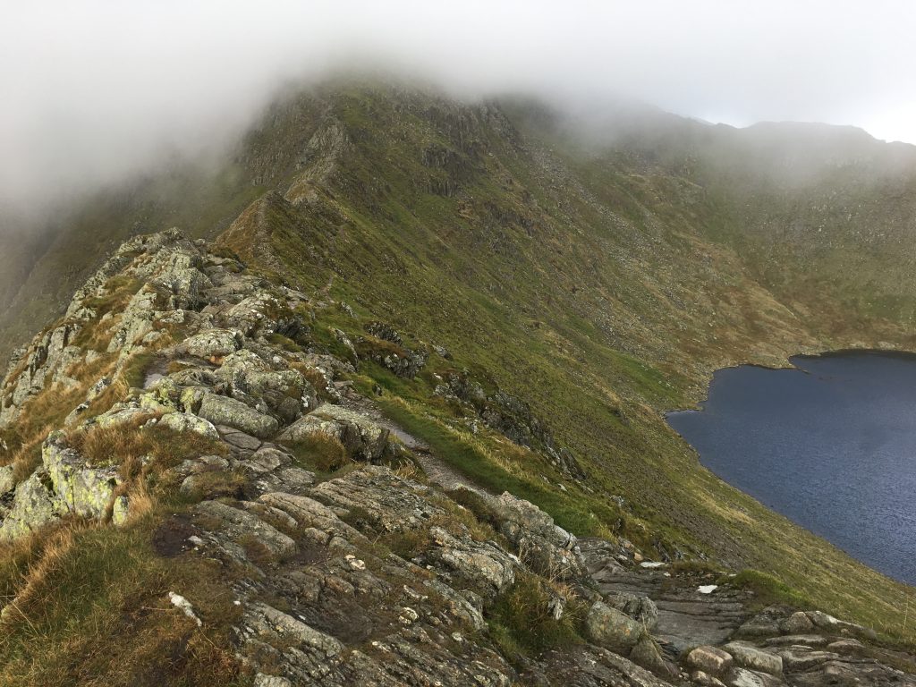
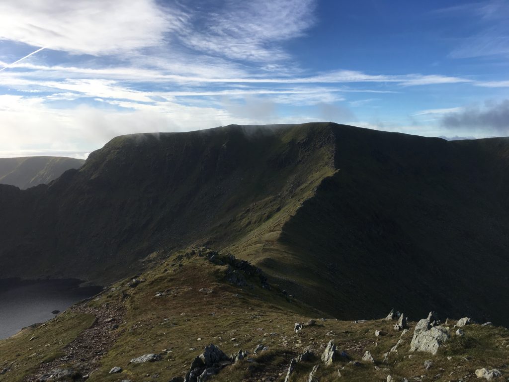
At the Hole-In-The-Wall I chose the Striding Edge route. This was more ridge-like and climbing than I had expected and I made sure that I slowed down and was thinking through everything carefully. It was a long way down both sides to either Red Tarn or Nethermost Cove and it would hurt, a lot.
Striding Edge and Red Tarn with Helvellyn hidden.
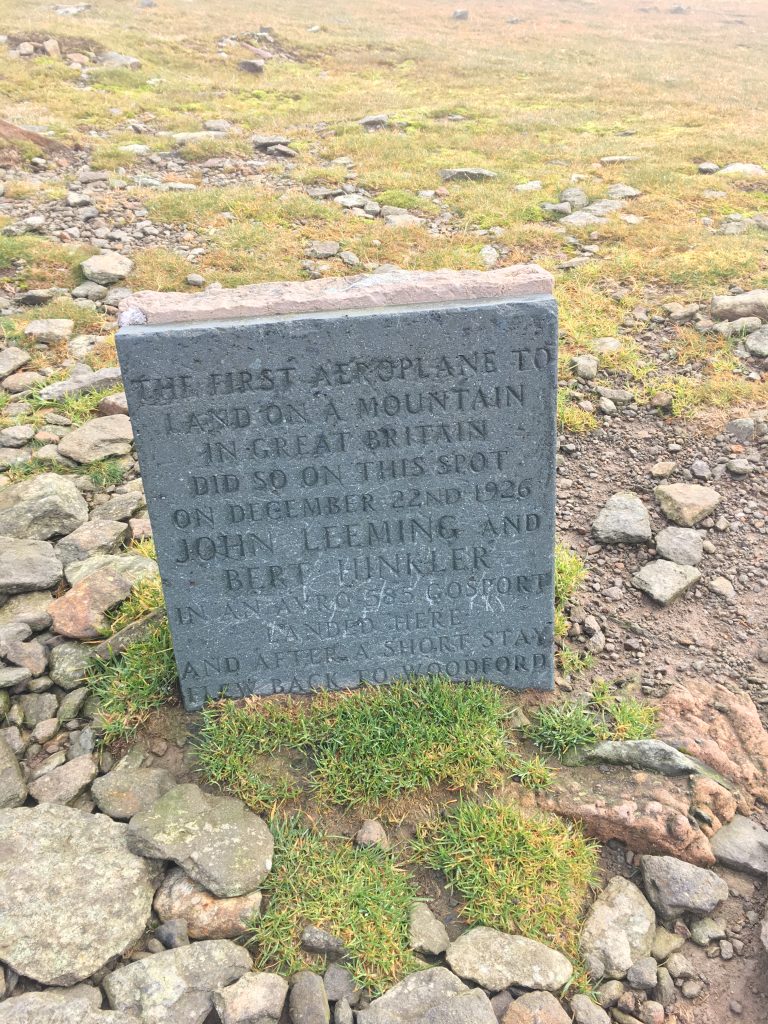
Striding Edge was mostly clear but with quite a wind chill and the cloud base was above the ridge but below Helvellyn. Parts of this ridge were challenging and I was always aware that my phone didn’t really have any signal, there weren’t many other people out either. Once the ridge was completed I had to find a way up the last scramble to the top. I saw the memorial to the airmen who landed a plane on top of this plateau.
Crazy Plane Stuff
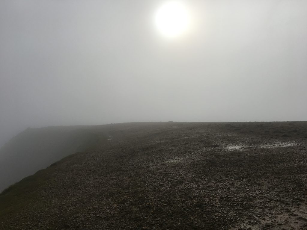
Helvellyn Summit
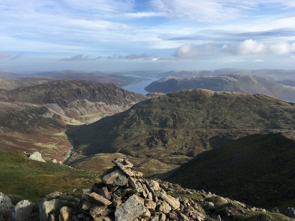
I had planned to walk back via a route near Raise, but chose to take the slightly shorter route down Swirral Edge and take in Catstye Cam. Had I stayed atop Helvellyn for about twenty minutes longer I would have had lovely clear weather up there. When I got to Catstye Cam the whole area was clear. After that it was a slog along good paths back to Glenridding.
Helvellyn from Catstye Cam
While I was walking I realised two things. One, I don’t like uneven steps made of stones, I’m much happier taking many little steps along a smooth path. Two, my left knee doesn’t like going down hill. The second thing was more a memory than a new thought. I have done plenty of hill walking to know my physical limits.
Ullswater from Catstye Cam
Now I am tempted with completing all the Wainwrights. I have no idea how long it would take me.
Some additions:
I heard RAF jets on my ascent. But I didn’t see them. This is about the fifth time I’ve heard planes but not seen them. I should probably get to the Mach Loop sometime.
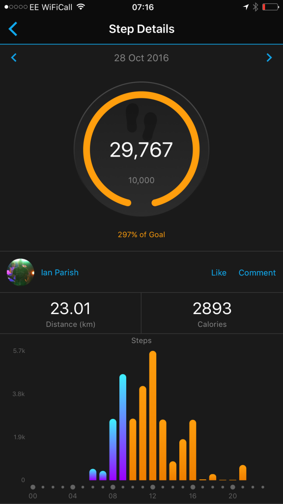
Here are my walking statistics for the day, although they don’t include any information about altitude: