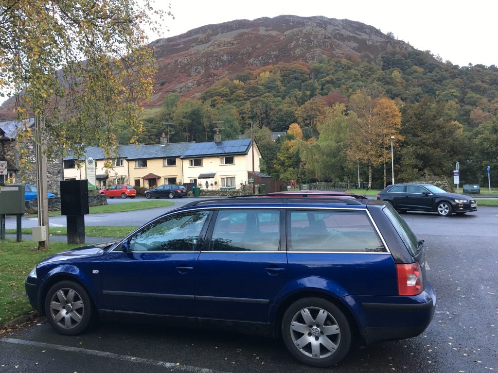
On 28 October I decided, after reviewing the weather, that I would attempt to scale Helvellyn the third tallest mountain in England. By attempt I mean that I would either get to the top or turn around very quickly, there aren’t that many escape routes. I parked the beast in Glenridding and check my equipment. Then I sauntered purposefully towards Mires Beck. I had planned to contour around Birkhouse Moor but in retrospect I shouldn’t have because I will need to head back there to complete that fell.

At the Hole-In-The-Wall I chose the Striding Edge route. This was more ridge-like and climbing than I had expected and I made sure that I slowed down and was thinking through everything carefully. It was a long way down both sides to either Red Tarn or Nethermost Cove and it would hurt, a lot.
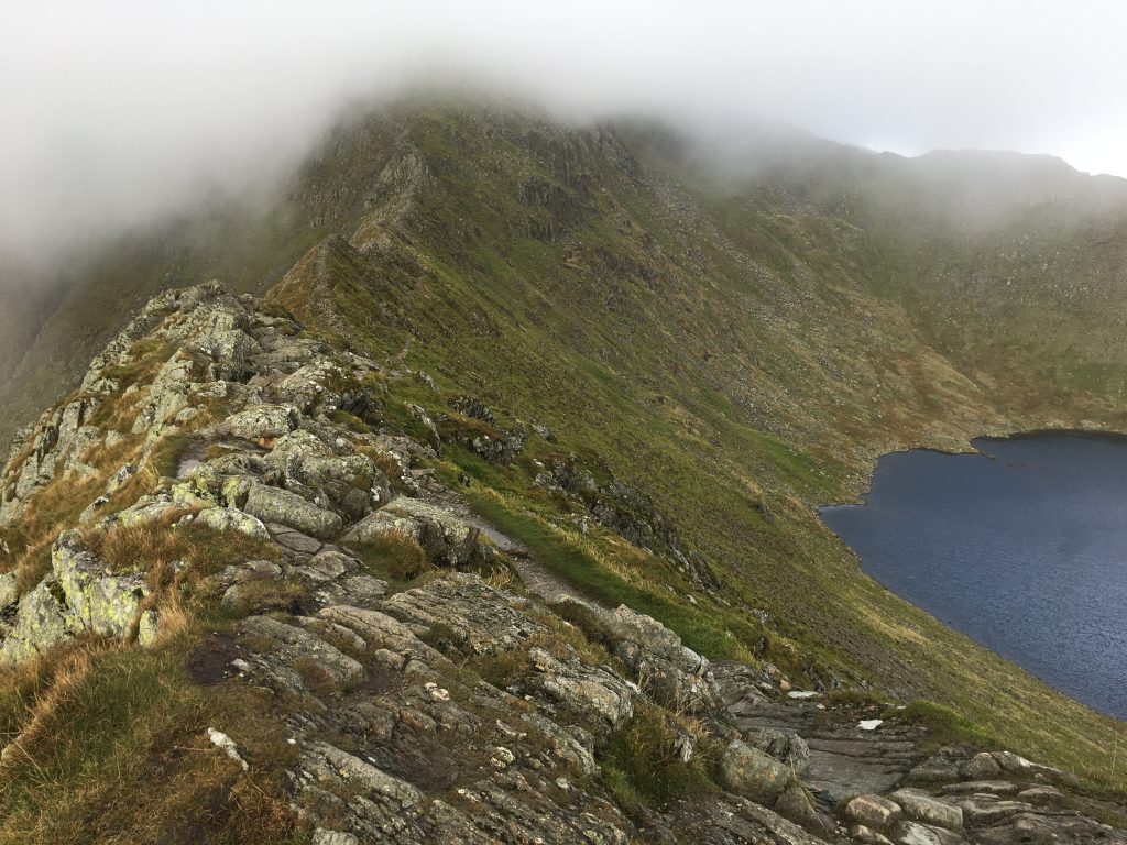
Striding Edge was mostly clear but with quite a wind chill and the cloud base was above the ridge but below Helvellyn. Parts of this ridge were challenging and I was always aware that my phone didn’t really have any signal, there weren’t many other people out either. Once the ridge was completed I had to find a way up the last scramble to the top. I saw the memorial to the airmen who landed a plane on top of this plateau.


I had planned to walk back via a route near Raise, but chose to take the slightly shorter route down Swirral Edge and take in Catstye Cam. Had I stayed atop Helvellyn for about twenty minutes longer I would have had lovely clear weather up there. When I got to Catstye Cam the whole area was clear. After that it was a slog along good paths back to Glenridding.

While I was walking I realised two things. One, I don’t like uneven steps made of stones, I’m much happier taking many little steps along a smooth path. Two, my left knee doesn’t like going down hill. The second thing was more a memory than a new thought. I have done plenty of hill walking to know my physical limits.

Now I am tempted with completing all the Wainwrights. I have no idea how long it would take me.
Some additions:
I heard RAF jets on my ascent. But I didn’t see them. This is about the fifth time I’ve heard planes but not seen them. I should probably get to the Mach Loop sometime.
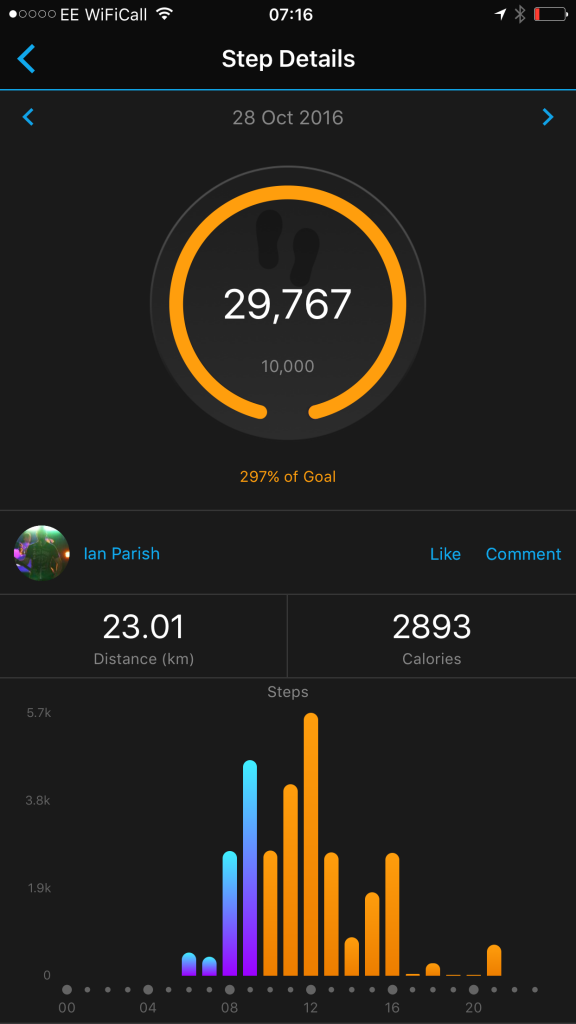
Here are my walking statistics for the day, although they don’t include any information about altitude: